


An Intriguing, Water-Involved Stone Row in Williston, Vermont
A Property Boundary... with Possible Indigenous Iconography


We broke records with high temperatures in the sixties at the end of February in Burlington, Vermont. After forgoing an outing on the first and sunnier of the two warm days, I put my projects on hold after finishing my radio show on the second day of weirdly warm weather and headed out to see some stonework. Almost felt like I had to…
Decided to head back to this hollow in Williston where I’ve found curious, brief stone rows along the inclines on both sides. First time I’ve been here in a year and a half or so. One of the features I revisited was this stone row on the south side of the hollow, which runs along a stream much of the way as it climbs the hill.


(If viewing/reading the newsletter on the web, be sure to click the pictures in the multi-picture galleries to view them full-size)
Raw video footage follows of the walk up this end or beginning of the stone row, from this disorganized stuff up to where the actual stone row, and what I believe to be a more ancient part, begins.
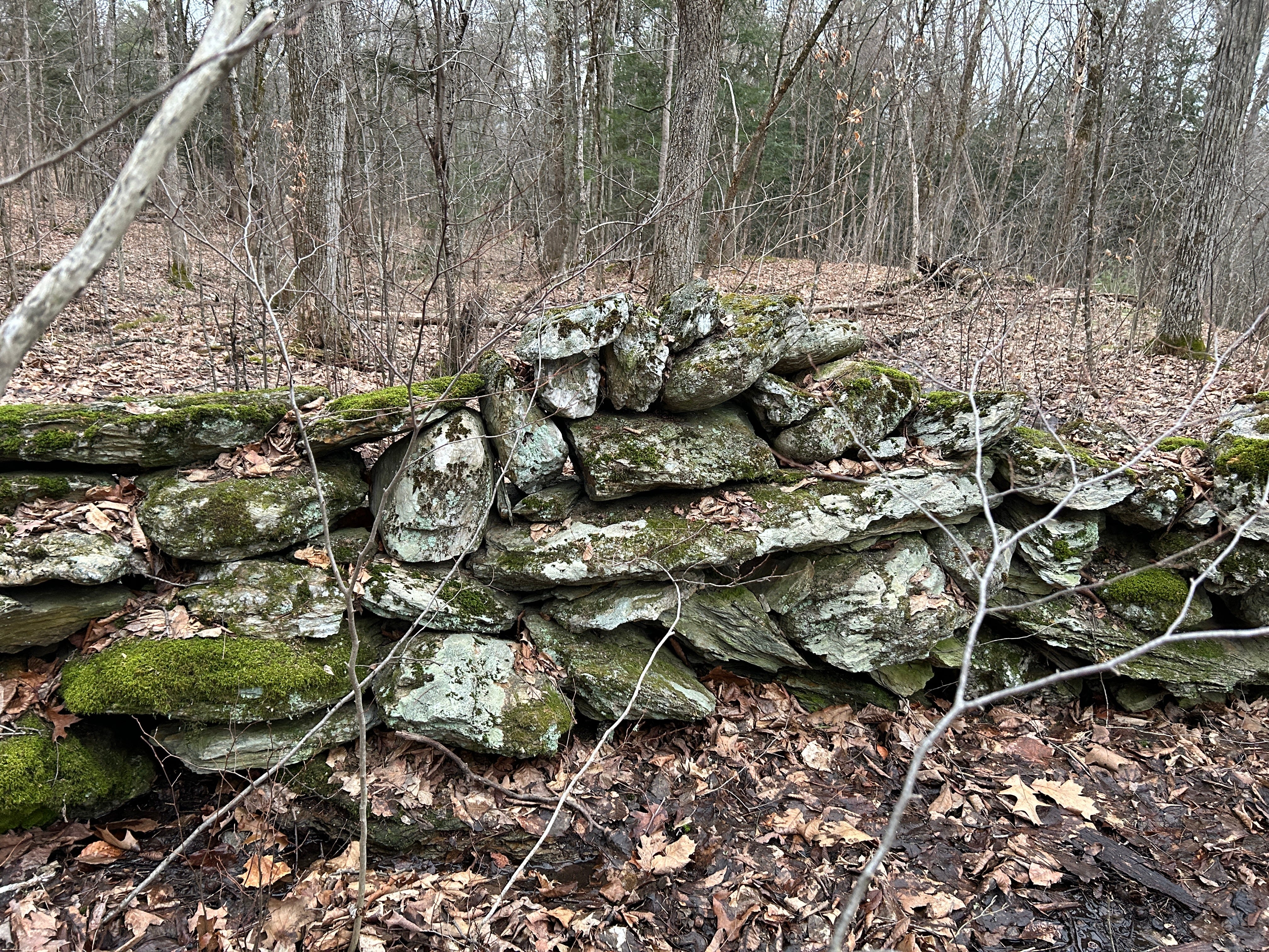
I try to keep an open yet somewhat skeptical mind in the field as I observe features. With that, I had to consider the chance the more “organized” end of this stone row, which abuts an old tree where the height drops off, was built using the tree as a support. How old was this — now dead — tree? Not that old. Certainly not ancient. That would make this a relatively new stone wall.
Although, at first glance, it appeared the stone row was built leaning on the old tree, on closer inspection it became clear this was not the case; instead the end assemblage sat on a larger stone, as much of this stone row does. There are large base stones all along its length. The tree’s growth impacted the end of the stone row, and looks to have lifted it a bit. But the stone row itself was clearly built independently of the tree.
This stone row is obviously a property boundary as the other side is Posted (thus, we only see one side of this stone row in my pictures, the public side). Still, I did take a close look, a walk-along up the stone row. Because, although utilized as a boundary, there appears to be potential Indigenous Serpent Iconography all along its short but sinuous length.


Though it doesn't zig-zag, it does shift subtly from side to side. It also undulates, arcing and dipping in height.


As there are places where the wall has been damaged as well, it occured to me as I looked at it this afternoon that this stone row nicely demonstrates the difference between simple damage, and arcs and dips constructed, built-in.
In this field footage clip, I came across fresh-looking damage to the stone row where it appeared whoever was posting the Posted signs tried to stand on top of it and brought the stones down. That’s… so wrong. But it does show what damage looks like versus the beautifully engineered arcs and dips we see elsewhere along this stone row’s undulating length.
It's clearly not laid in traditional courses. There are surrounded stones and other potential zoomorphic features suggested by the creative coursework, including ridge fins. These features continue up through and past the area where the stream cuts through the stone row, the water-involved stonework seen in the opening video.


Glad I took advantage of the weirdly warm weather. After reaching 60 that afternoon, the temperatures dipped down to 16 degrees that night. With the wind, it felt like -1.
I’ll head out again, so long as the snow holds off, though I doubt I see temperatures like this for a while. You know, by the time they come around again, there will likely be bugs. No bugs in February. That was pretty sweet.
The support of paid subscribers is also pretty sweet… as a thank you to those of you who support my efforts, more photos and videos follow below….
Keep reading with a 7-day free trial
Subscribe to Ancient Stone Mysteries to keep reading this post and get 7 days of free access to the full post archives.