On The Grid?
Puzzling Out Massive, Mysterious Landscape Features and More in UVM's Jericho Research Forest
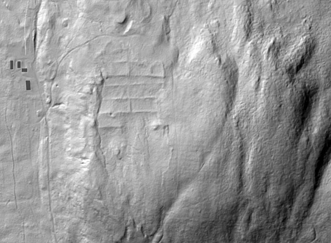
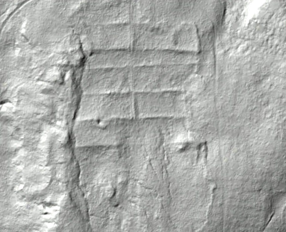
Imagine coming across immense mounds and large ridges on a hill in a forest, going home, looking it up on LIDAR, and seeing a massive grid laid out across the hill...
What?
![](https://substackcdn.com/image/fetch/w_1456,c_limit,f_auto,q_auto:good,fl_progressive:steep/https%3A%2F%2Fsubstack-post-media.s3.amazonaws.com%2Fpublic%2Fimages%2F178def9a-a9c2-42e2-a908-93ddfba07a61_1057x776.jpeg)
This post accompanies and echoes my new video presentation, Experiencing Mysterious Earthworks, Odd Boulders, and More in UVM's Jericho Research Forest — free to watch on my Ancient Stone Mysteries of New England YouTube Channel:
This post, however, is more than a transcript and includes newly shared still photos, rather than screen captures from the video, with a couple of noted and likely obvious exceptions.
![](https://substackcdn.com/image/fetch/w_1456,c_limit,f_auto,q_auto:good,fl_progressive:steep/https%3A%2F%2Fsubstack-post-media.s3.amazonaws.com%2Fpublic%2Fimages%2Ff9b1aa6c-1561-4af6-98b5-d5588a19375c_974x790.jpeg)
LIDAR, Laser Imaging Detection and Ranging, uses airborne lasers and GPS positioning to map the ground below, giving us a glimpse of the terrain where it looks like all the trees and vegetation have been removed, as if we were looking at bare ground.
So, what was up with this grid?
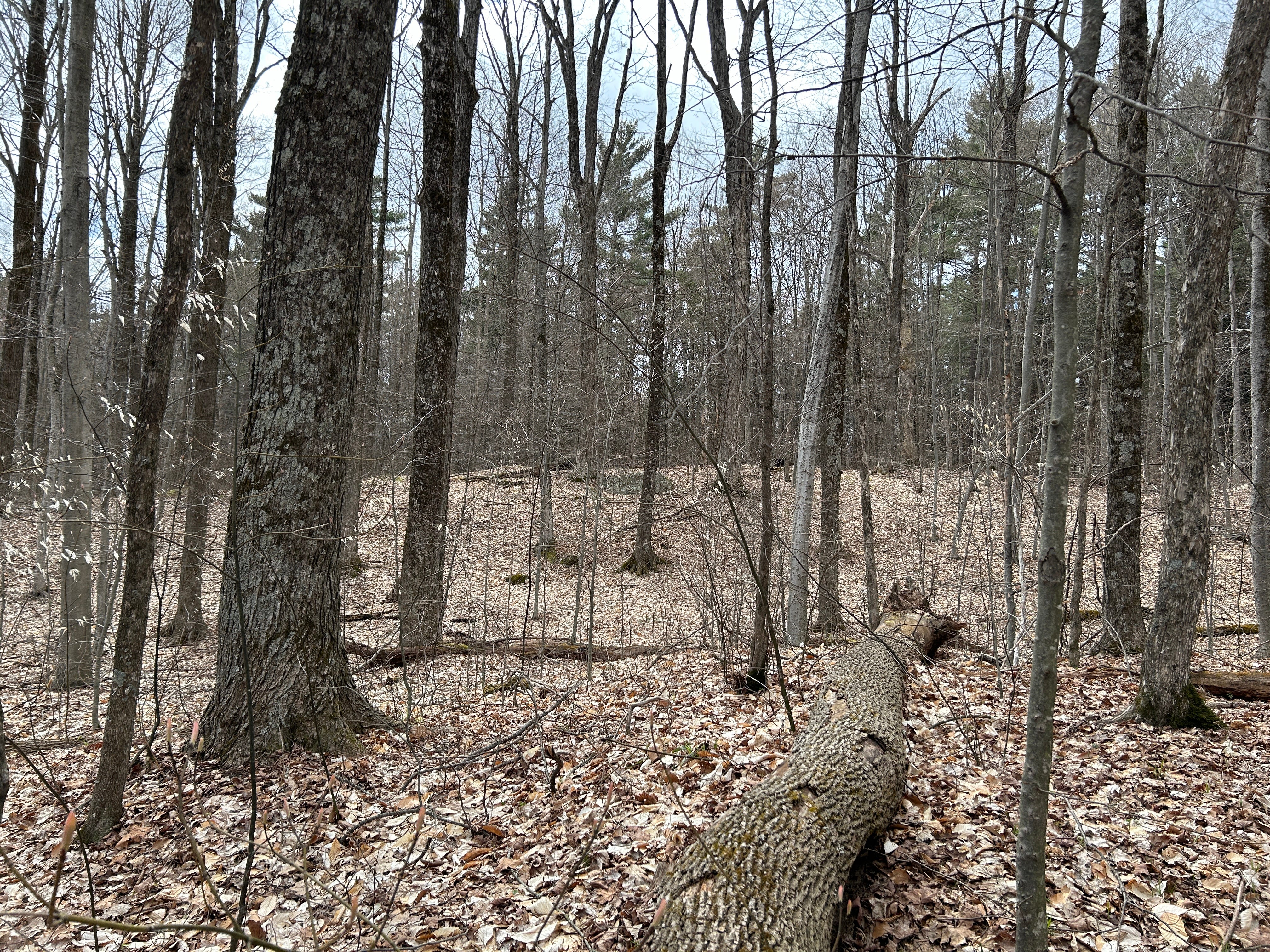
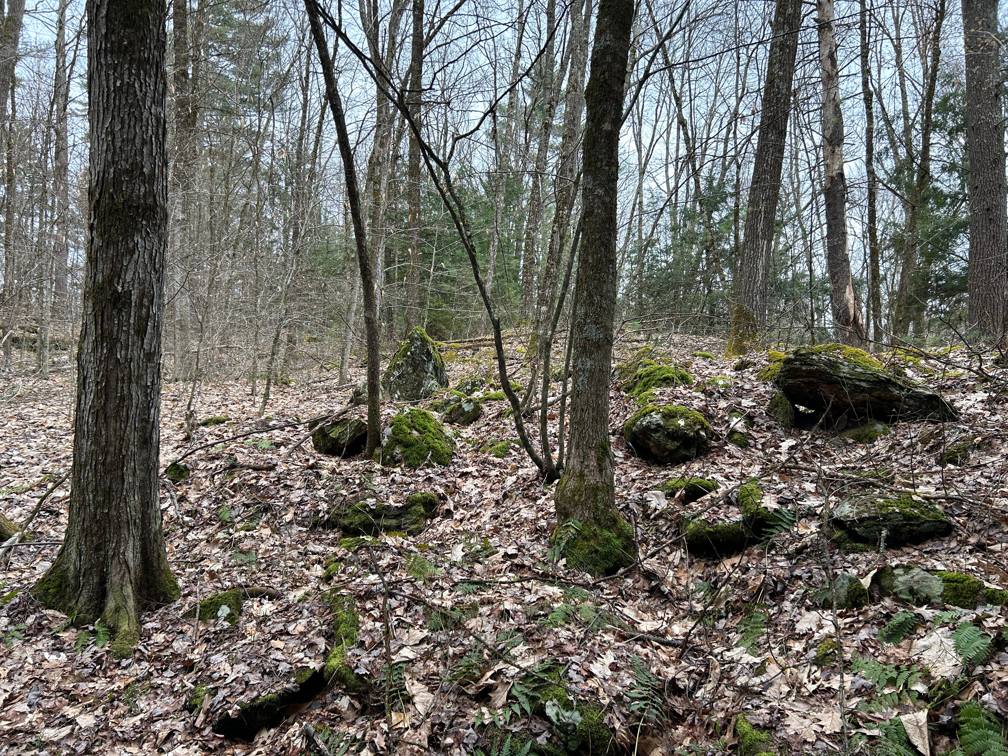
Hiking through the UVM — University of Vermont — Jericho Research Forest, the southeast or lower left-hand corner is up on the hill, and it stands out. This is what I came across before I knew there was anything in the forest.
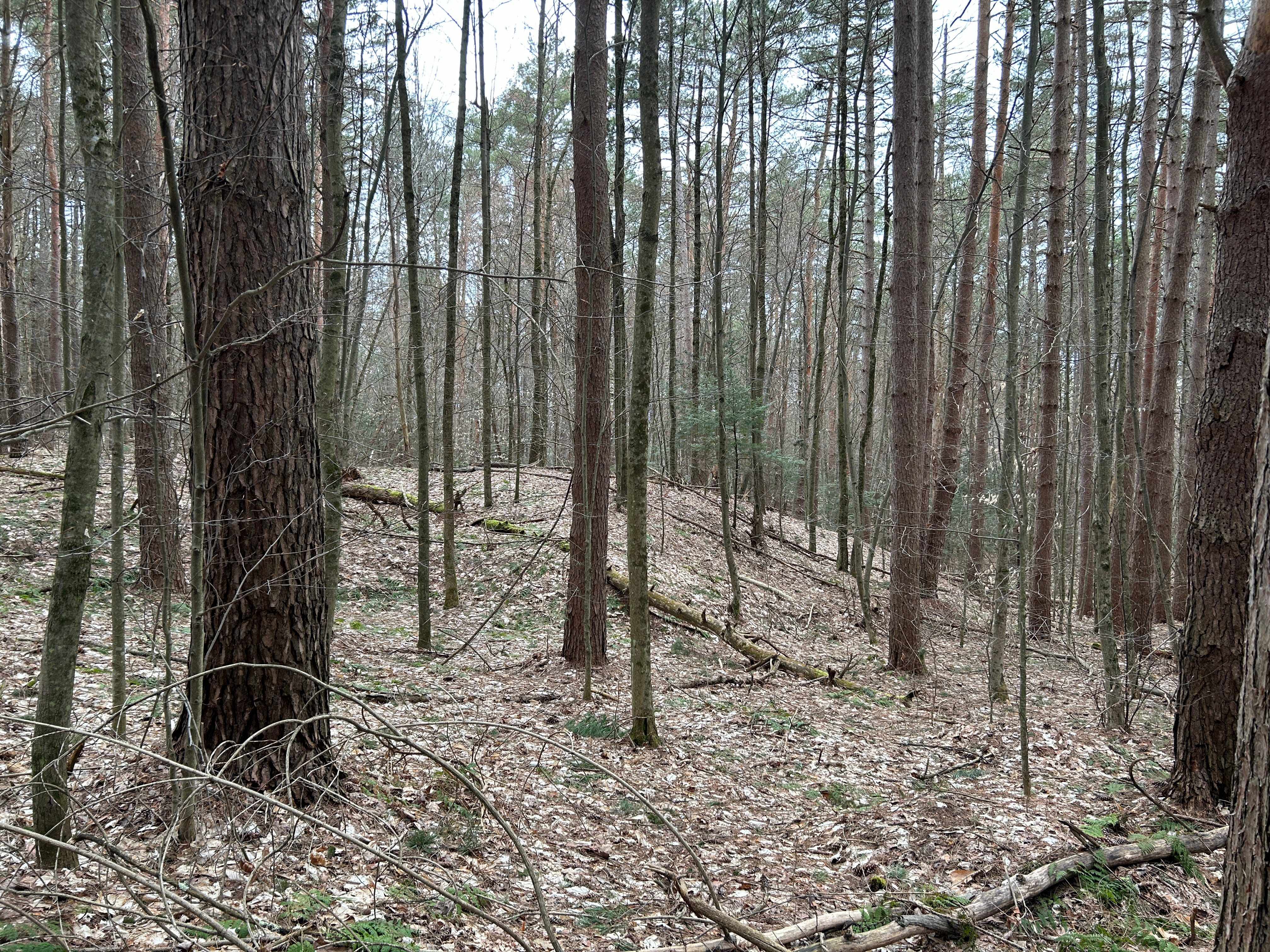
Wish I could show it to you better… it was rather difficult to capture the size and shape of this earthwork in photos or on video. There’s not much you can see of its shape even in shots from a distance, and the leaf cover renders everything a little two-dimensional.
(Click on any gallery photo in the article to see the entire photo at a larger size)
![](https://substackcdn.com/image/fetch/w_474,c_limit,f_auto,q_auto:good,fl_progressive:steep/https%3A%2F%2Fsubstack-post-media.s3.amazonaws.com%2Fpublic%2Fimages%2F4bebfd09-9562-40fe-a87f-abfaf10b6632_4032x3024.jpeg)
![](https://substackcdn.com/image/fetch/w_474,c_limit,f_auto,q_auto:good,fl_progressive:steep/https%3A%2F%2Fsubstack-post-media.s3.amazonaws.com%2Fpublic%2Fimages%2F125fb137-4aac-4326-82e6-b6ee4fa191b1_4032x3024.jpeg)
![](https://substackcdn.com/image/fetch/w_474,c_limit,f_auto,q_auto:good,fl_progressive:steep/https%3A%2F%2Fsubstack-post-media.s3.amazonaws.com%2Fpublic%2Fimages%2Fc8e916ad-cf74-4fa2-b539-361d45db2094_4032x3024.jpeg)
![](https://substackcdn.com/image/fetch/w_474,c_limit,f_auto,q_auto:good,fl_progressive:steep/https%3A%2F%2Fsubstack-post-media.s3.amazonaws.com%2Fpublic%2Fimages%2F23a756da-c449-4936-9f0b-acee76cd675d_4032x3024.jpeg)
![](https://substackcdn.com/image/fetch/w_474,c_limit,f_auto,q_auto:good,fl_progressive:steep/https%3A%2F%2Fsubstack-post-media.s3.amazonaws.com%2Fpublic%2Fimages%2F81ec207a-0949-4abe-a25e-cd759b21f44d_4032x3024.jpeg)
![](https://substackcdn.com/image/fetch/w_474,c_limit,f_auto,q_auto:good,fl_progressive:steep/https%3A%2F%2Fsubstack-post-media.s3.amazonaws.com%2Fpublic%2Fimages%2F58b5b73a-b61e-46fd-9899-9b747c2e1dd2_4032x3024.jpeg)
UVM's Forest Manager Jess Wikle answered my questions about the grid via email and sent me some interesting photos. A 1937 aerial photo of the region features the hill and its grid. She pointed out that the white isn't snow, it's sand.
![](https://substackcdn.com/image/fetch/w_474,c_limit,f_auto,q_auto:good,fl_progressive:steep/https%3A%2F%2Fsubstack-post-media.s3.amazonaws.com%2Fpublic%2Fimages%2Fe1f6bb9e-1db4-4485-869c-3d18b01e9c30_5669x4469.jpeg)
![](https://substackcdn.com/image/fetch/w_474,c_limit,f_auto,q_auto:good,fl_progressive:steep/https%3A%2F%2Fsubstack-post-media.s3.amazonaws.com%2Fpublic%2Fimages%2F8da2e320-5c5c-4e3c-9d41-540c5abf1fbc_658x834.jpeg)
![](https://substackcdn.com/image/fetch/w_474,c_limit,f_auto,q_auto:good,fl_progressive:steep/https%3A%2F%2Fsubstack-post-media.s3.amazonaws.com%2Fpublic%2Fimages%2F40737bbe-2465-4cb8-a394-625d75bd516a_322x171.jpeg)
She shared a little of the history here: due to soil damage, the hill was abandoned as a farm in the 1930s after seeing heavy agricultural use for row crops, orchards, and some small animals since the 1790s. UVM got the property in a land swap in the late 1930s, when it was described as sand blows and sand dunes.
![](https://substackcdn.com/image/fetch/w_1456,c_limit,f_auto,q_auto:good,fl_progressive:steep/https%3A%2F%2Fsubstack-post-media.s3.amazonaws.com%2Fpublic%2Fimages%2Fcd9f77fd-e07d-4c8e-819c-98841f95fe1e_1920x1080.png)
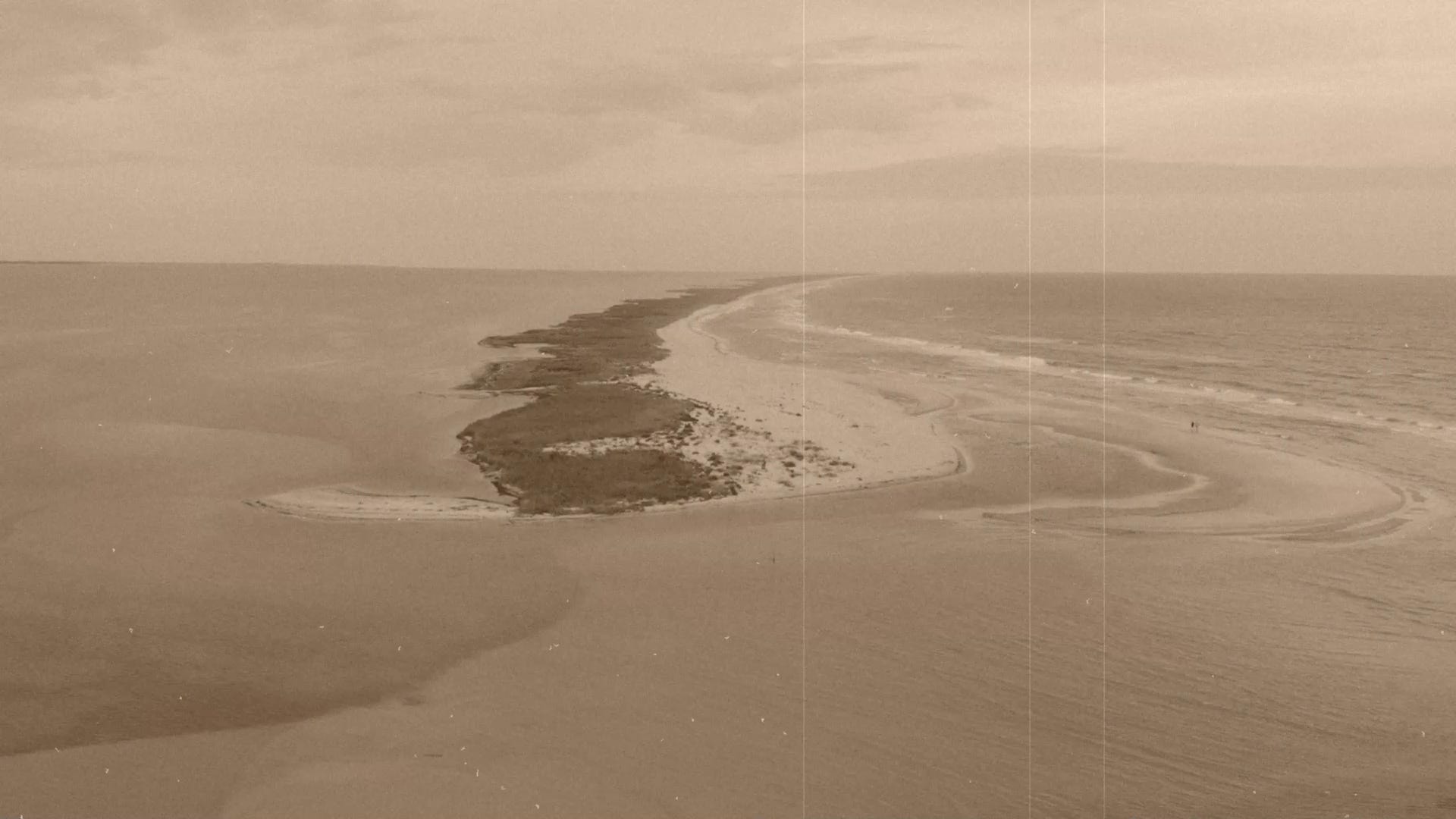
Some of this hill was underwater towards the end of the Ice Age, surrounded by the descending waters of glacial lakes Nashville, Mansfield, and Vermont. Could it be that part of the reason the hill is so sandy is that it was once a beach?
When I mentioned the hill rising above the glacial lakes, forest manager Jess Wikle said the forest soil maps, though sometimes incorrect, showed there were glacial till soils and not lake sediment on the hilltop — and mentioned she had tentative plans to dig test pits to ground truth the soil maps.
Jess Wikle said the old photo below can be dated to between 1939 and 1941, because between 1939 and 1941, they began planting conifers to stabilize the soil on the hill. This planting schematic, designed in concert with the 1939 Soil Conservation Service report, shows the efforts at that time to rehabilitate the land. It matches the location of the grid, though the grid itself seems to predate it based on the 1937 Aerial Photo (above).
![](https://substackcdn.com/image/fetch/w_720,c_limit,f_auto,q_auto:good,fl_progressive:steep/https%3A%2F%2Fsubstack-post-media.s3.amazonaws.com%2Fpublic%2Fimages%2F5ea5b2eb-54bb-4b61-97f4-5f6404eddfe9_1718x1036.jpeg)
![](https://substackcdn.com/image/fetch/w_720,c_limit,f_auto,q_auto:good,fl_progressive:steep/https%3A%2F%2Fsubstack-post-media.s3.amazonaws.com%2Fpublic%2Fimages%2F739f53c5-0b59-4705-b1d1-c83d85dc10e3_1563x2055.jpeg)
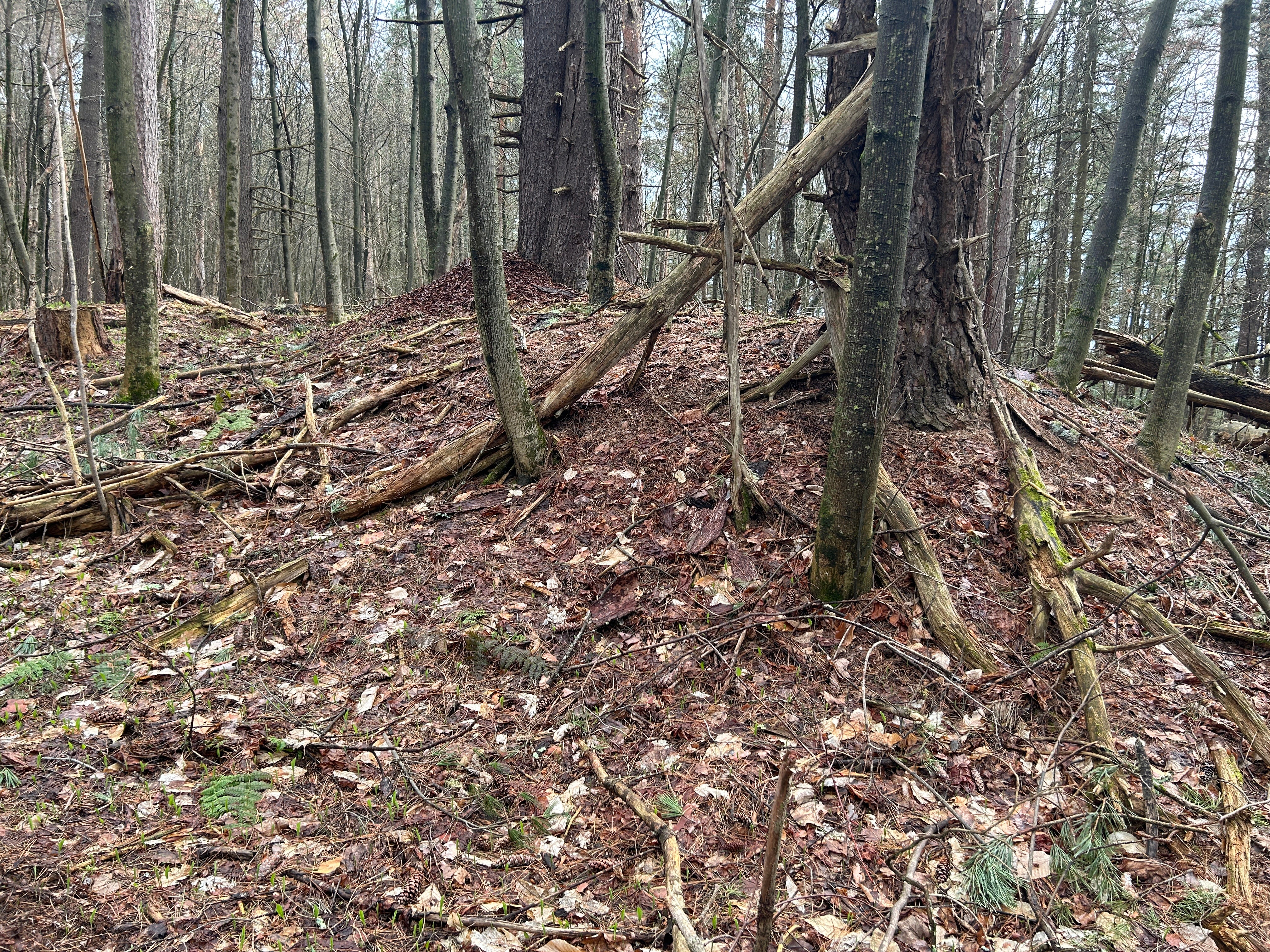
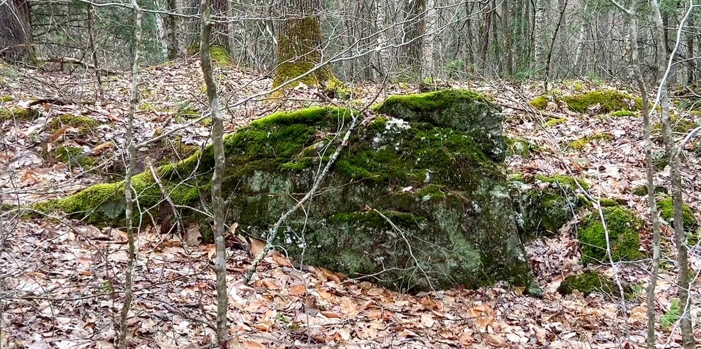
Jess, the Forest Manager, told me she'd dug a small soil pit in one of the grid's ridges and found it to just contain soil. She wondered if the mounded area of the grids was some combination of sand and soil that blew against the brush fences, plus decomposing material, over time.
I wondered if there could be stones beneath the mounds given how they show up on the LIDAR.
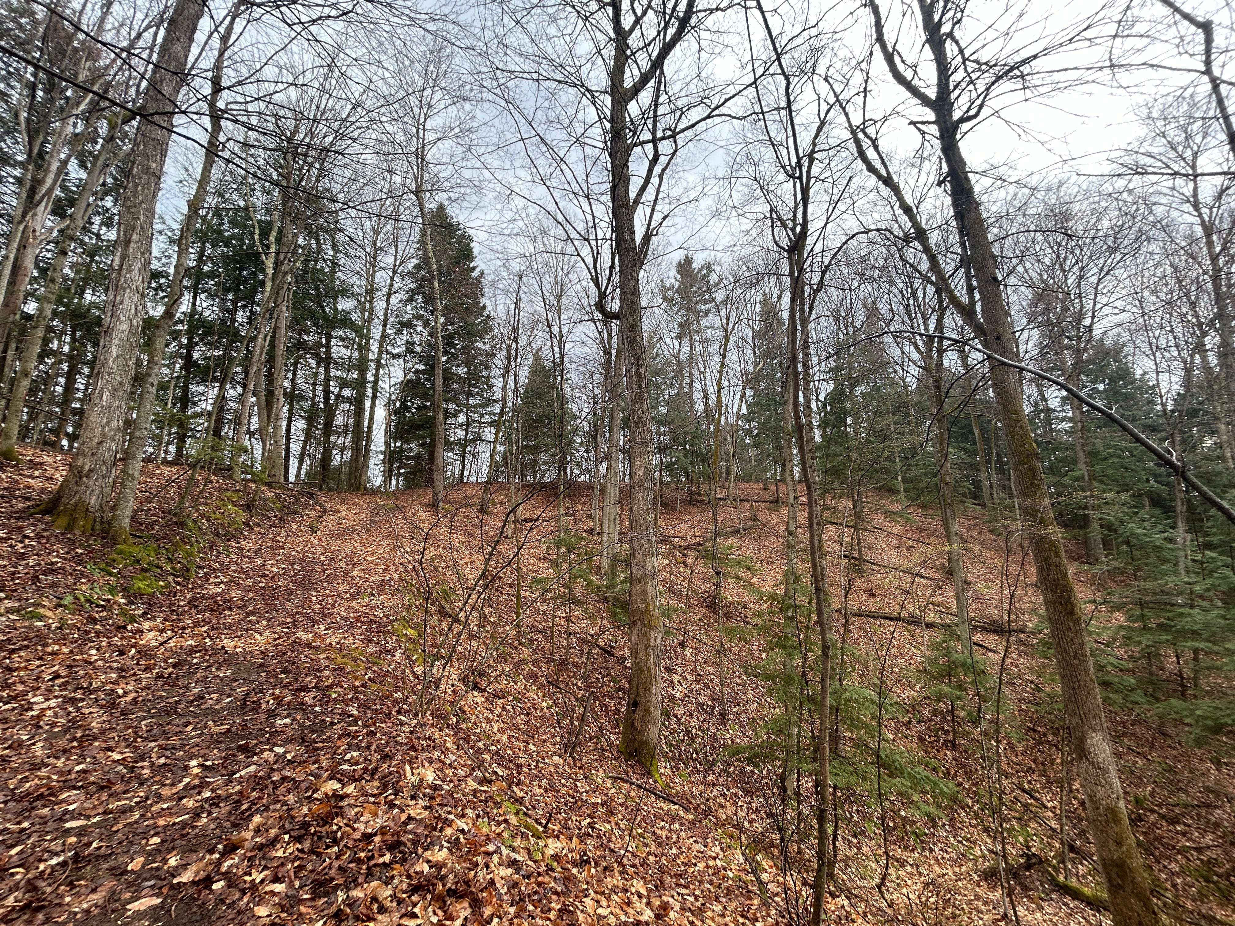
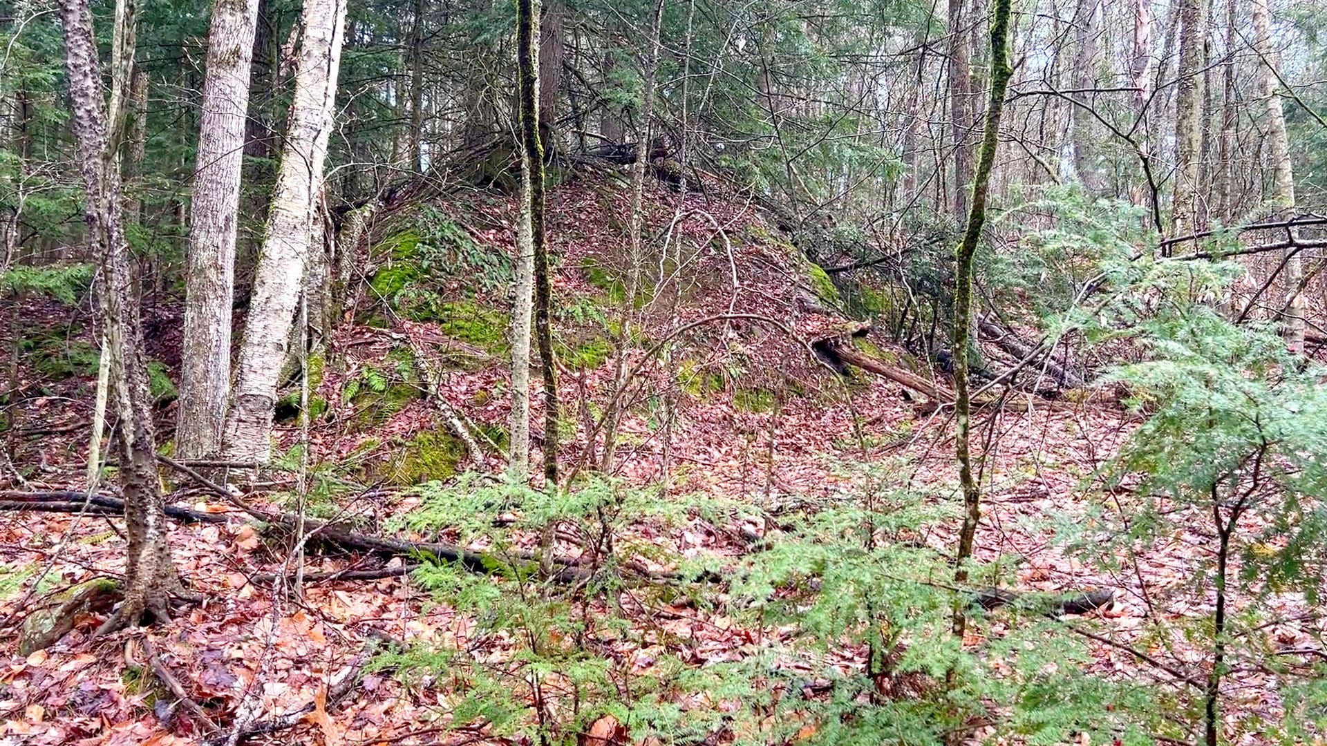
Down in the northwest corner, the upper left on a map, the ridges are huge.
![](https://substackcdn.com/image/fetch/w_1456,c_limit,f_auto,q_auto:good,fl_progressive:steep/https%3A%2F%2Fsubstack-post-media.s3.amazonaws.com%2Fpublic%2Fimages%2F46d0e698-4571-4284-acee-7272df685563_4032x3024.jpeg)
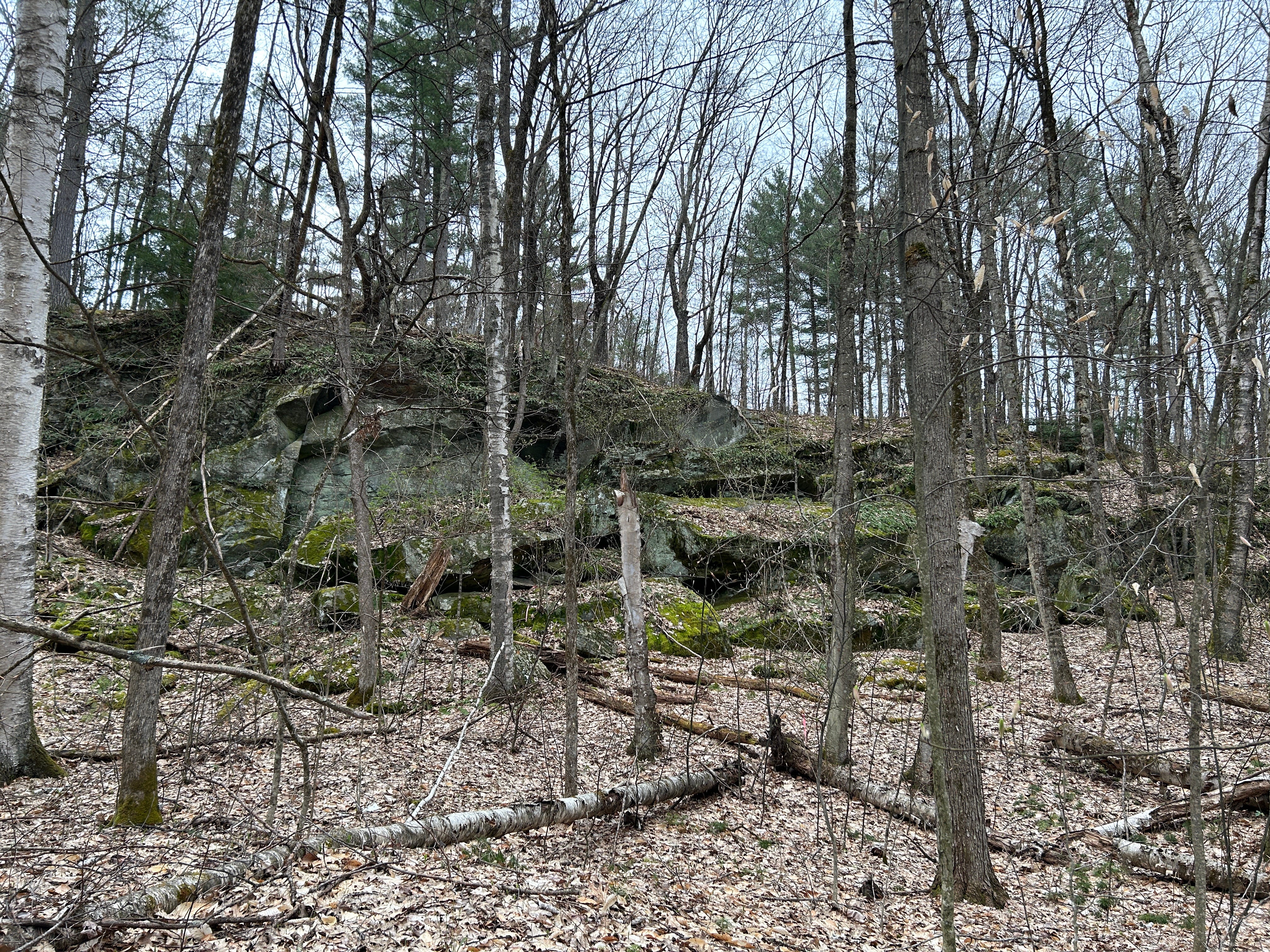
As Jess Wikle said, much of the other oddness on this hillside is likely also related to severe soil disturbance caused by farming. But not all of the hill saw such heavy use. She also said that some of the wooded areas that can be seen in the old aerial photo could have been farmed woodlots that were never fully cleared but used regularly for timber. Stonework in these areas may not have any link to agricultural activity,
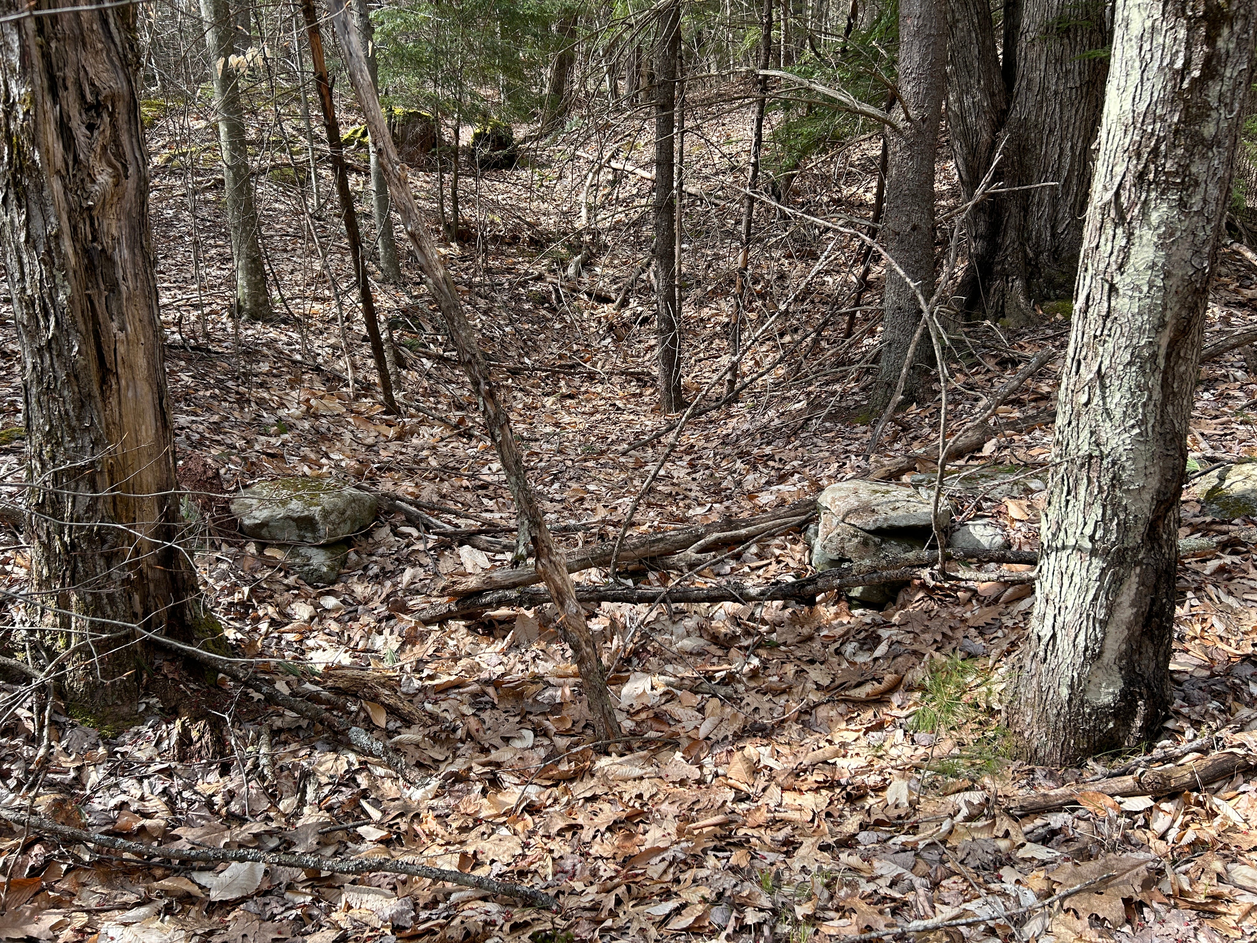
Which is interesting considering I did find a curious stone pile in one of those wooded areas.
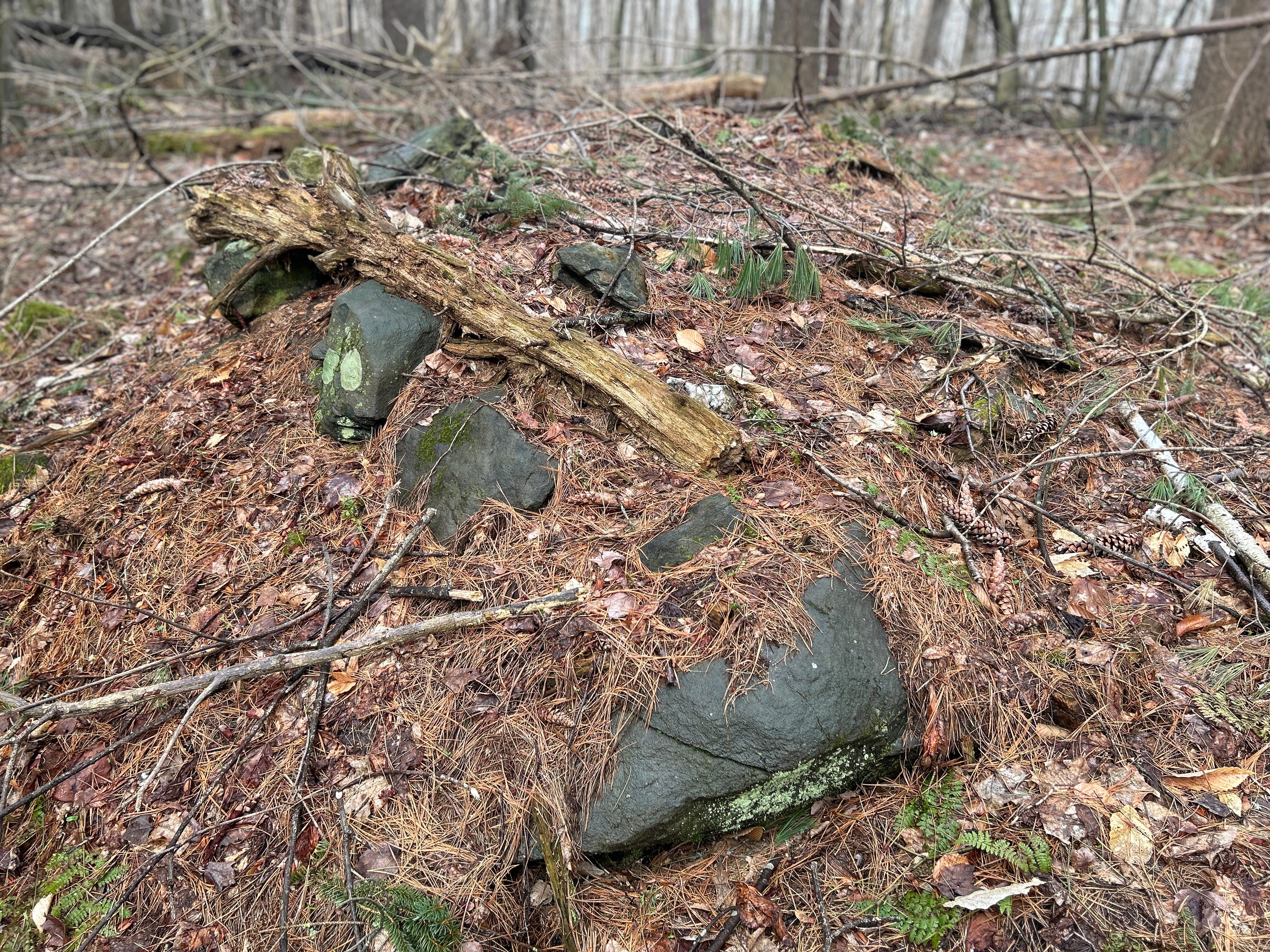
Could this be a stone prayer?
As I don't disturb what I find, I try to puzzle this out through observation. The longer I look, the more interesting things I see.
![](https://substackcdn.com/image/fetch/w_474,c_limit,f_auto,q_auto:good,fl_progressive:steep/https%3A%2F%2Fsubstack-post-media.s3.amazonaws.com%2Fpublic%2Fimages%2Ffa4d82cc-68b5-4704-9be4-4a73877ded4f_4032x3024.jpeg)
![](https://substackcdn.com/image/fetch/w_474,c_limit,f_auto,q_auto:good,fl_progressive:steep/https%3A%2F%2Fsubstack-post-media.s3.amazonaws.com%2Fpublic%2Fimages%2F9f2d441c-a71d-404f-afda-306e624ac466_4032x3024.jpeg)
![](https://substackcdn.com/image/fetch/w_474,c_limit,f_auto,q_auto:good,fl_progressive:steep/https%3A%2F%2Fsubstack-post-media.s3.amazonaws.com%2Fpublic%2Fimages%2Fb54591ff-3b57-4444-97e6-aa3035614cdd_4032x3024.jpeg)
![](https://substackcdn.com/image/fetch/w_474,c_limit,f_auto,q_auto:good,fl_progressive:steep/https%3A%2F%2Fsubstack-post-media.s3.amazonaws.com%2Fpublic%2Fimages%2F4bcff8f0-0cd5-4f93-949a-1e573a8f0367_4032x3024.jpeg)
![](https://substackcdn.com/image/fetch/w_474,c_limit,f_auto,q_auto:good,fl_progressive:steep/https%3A%2F%2Fsubstack-post-media.s3.amazonaws.com%2Fpublic%2Fimages%2Fb9fc46a3-998e-403b-a907-d7bce706ac3d_4032x3024.jpeg)
![](https://substackcdn.com/image/fetch/w_474,c_limit,f_auto,q_auto:good,fl_progressive:steep/https%3A%2F%2Fsubstack-post-media.s3.amazonaws.com%2Fpublic%2Fimages%2F3aa38913-e7a5-45e9-8eea-55e9c1188df3_4032x3024.jpeg)
![](https://substackcdn.com/image/fetch/w_474,c_limit,f_auto,q_auto:good,fl_progressive:steep/https%3A%2F%2Fsubstack-post-media.s3.amazonaws.com%2Fpublic%2Fimages%2F8be34d1f-d5f1-4424-84f3-020bc46f445b_4032x3024.jpeg)
![](https://substackcdn.com/image/fetch/w_474,c_limit,f_auto,q_auto:good,fl_progressive:steep/https%3A%2F%2Fsubstack-post-media.s3.amazonaws.com%2Fpublic%2Fimages%2F3cbd985b-a387-44af-bddc-2c0a5d297352_4032x3024.jpeg)
![](https://substackcdn.com/image/fetch/w_474,c_limit,f_auto,q_auto:good,fl_progressive:steep/https%3A%2F%2Fsubstack-post-media.s3.amazonaws.com%2Fpublic%2Fimages%2Fd6b0d65e-580e-4718-b8c0-1dfbf7e8dcd4_4032x3024.jpeg)
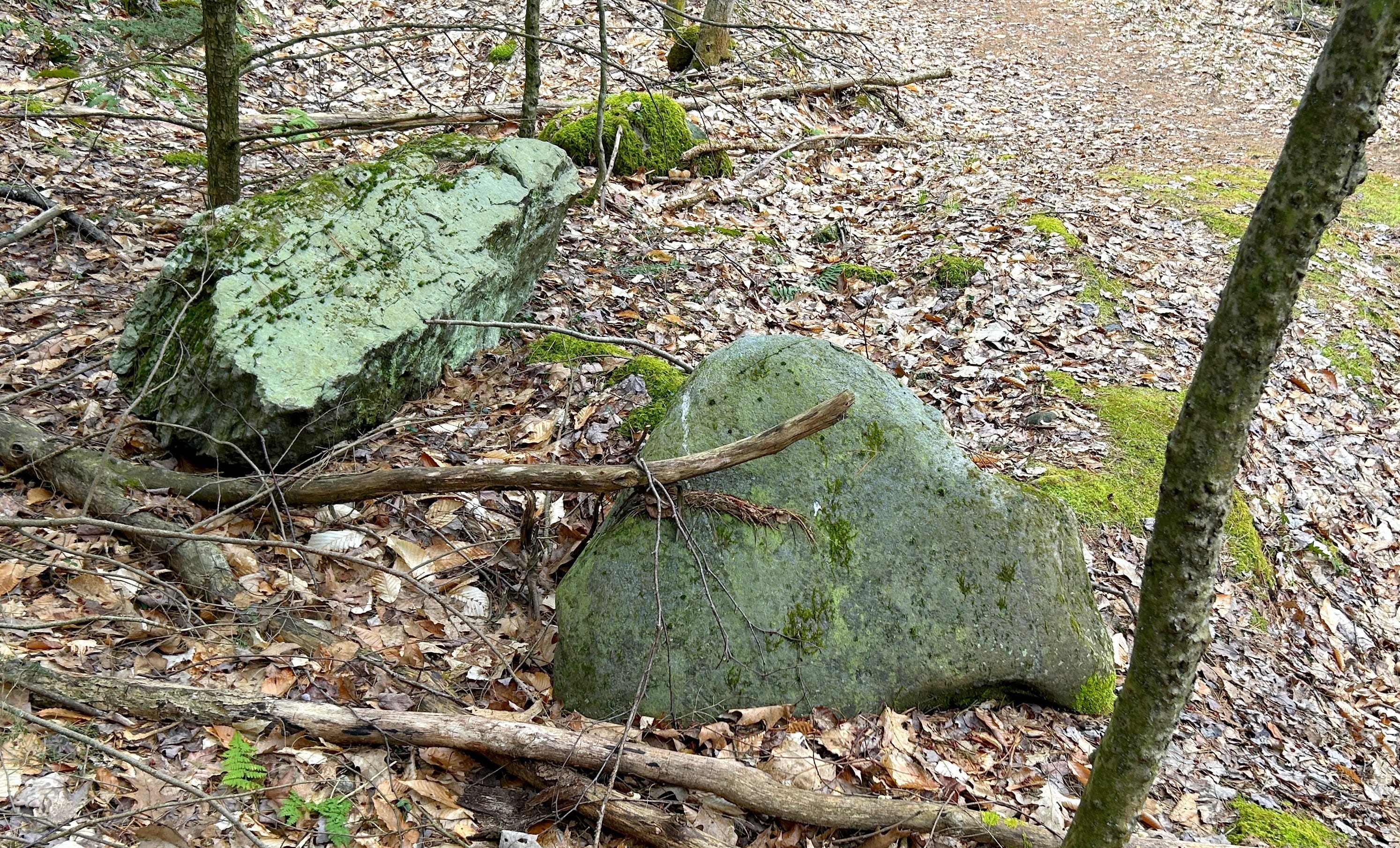
Could this be a turtle mound? Large stones on either end could be the head or tail of a turtle. Admittedly, with the mystery of the grid apparently solved, it was good to find something more like the ancient stone mysteries I usually seek out.
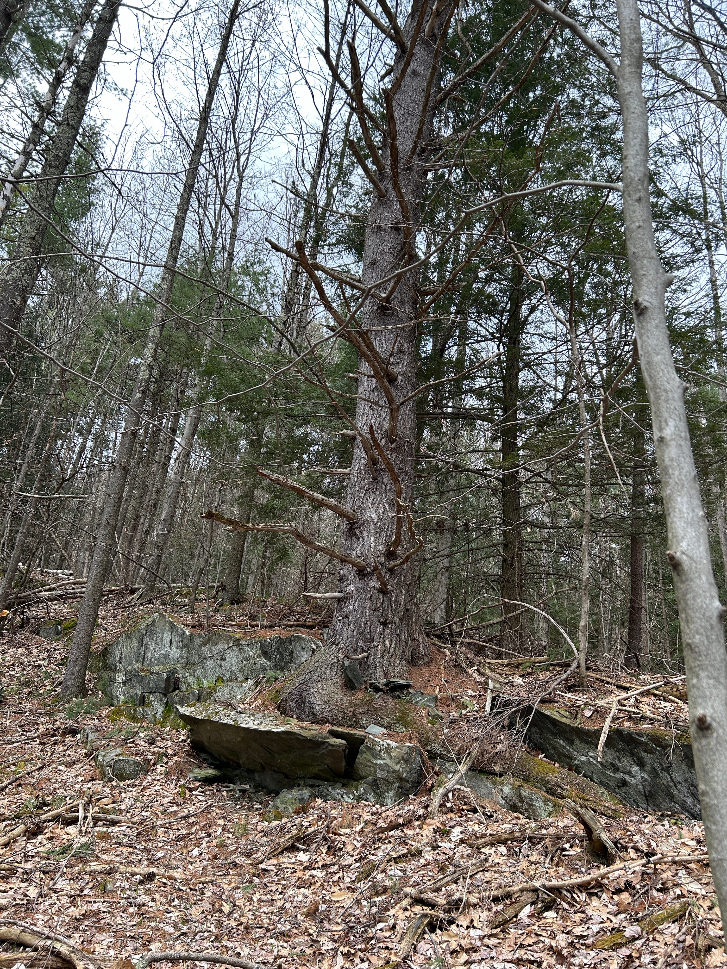
Other stones circled the hill's summit on the non-grid side, including one which looked like it could be a split stone, which could be significant. There were some curious-looking flat stones there as well.
![](https://substackcdn.com/image/fetch/w_474,c_limit,f_auto,q_auto:good,fl_progressive:steep/https%3A%2F%2Fsubstack-post-media.s3.amazonaws.com%2Fpublic%2Fimages%2F3abebe7b-55dc-4e9d-896c-330b0ae5e060_4032x3024.jpeg)
![](https://substackcdn.com/image/fetch/w_474,c_limit,f_auto,q_auto:good,fl_progressive:steep/https%3A%2F%2Fsubstack-post-media.s3.amazonaws.com%2Fpublic%2Fimages%2F8b624776-25c7-4664-ab8b-b756de2f497b_4032x3024.jpeg)
![](https://substackcdn.com/image/fetch/w_474,c_limit,f_auto,q_auto:good,fl_progressive:steep/https%3A%2F%2Fsubstack-post-media.s3.amazonaws.com%2Fpublic%2Fimages%2F309049a4-c7d0-4d4d-b6e8-35c78962abcc_4032x3024.jpeg)
![](https://substackcdn.com/image/fetch/w_720,c_limit,f_auto,q_auto:good,fl_progressive:steep/https%3A%2F%2Fsubstack-post-media.s3.amazonaws.com%2Fpublic%2Fimages%2F94eed67b-3afa-4e4e-881c-2cfcd0dc577d_4032x3024.jpeg)
![](https://substackcdn.com/image/fetch/w_720,c_limit,f_auto,q_auto:good,fl_progressive:steep/https%3A%2F%2Fsubstack-post-media.s3.amazonaws.com%2Fpublic%2Fimages%2F8b4f4604-1109-465b-9f17-d3a494e2990c_4032x3024.jpeg)
![](https://substackcdn.com/image/fetch/w_720,c_limit,f_auto,q_auto:good,fl_progressive:steep/https%3A%2F%2Fsubstack-post-media.s3.amazonaws.com%2Fpublic%2Fimages%2Fa3f71bb1-7fa4-45d9-896a-9281140f1262_4032x3024.jpeg)
![](https://substackcdn.com/image/fetch/w_720,c_limit,f_auto,q_auto:good,fl_progressive:steep/https%3A%2F%2Fsubstack-post-media.s3.amazonaws.com%2Fpublic%2Fimages%2Fdef406a2-0765-436c-a9f6-313ac4c7b61a_4032x3024.jpeg)
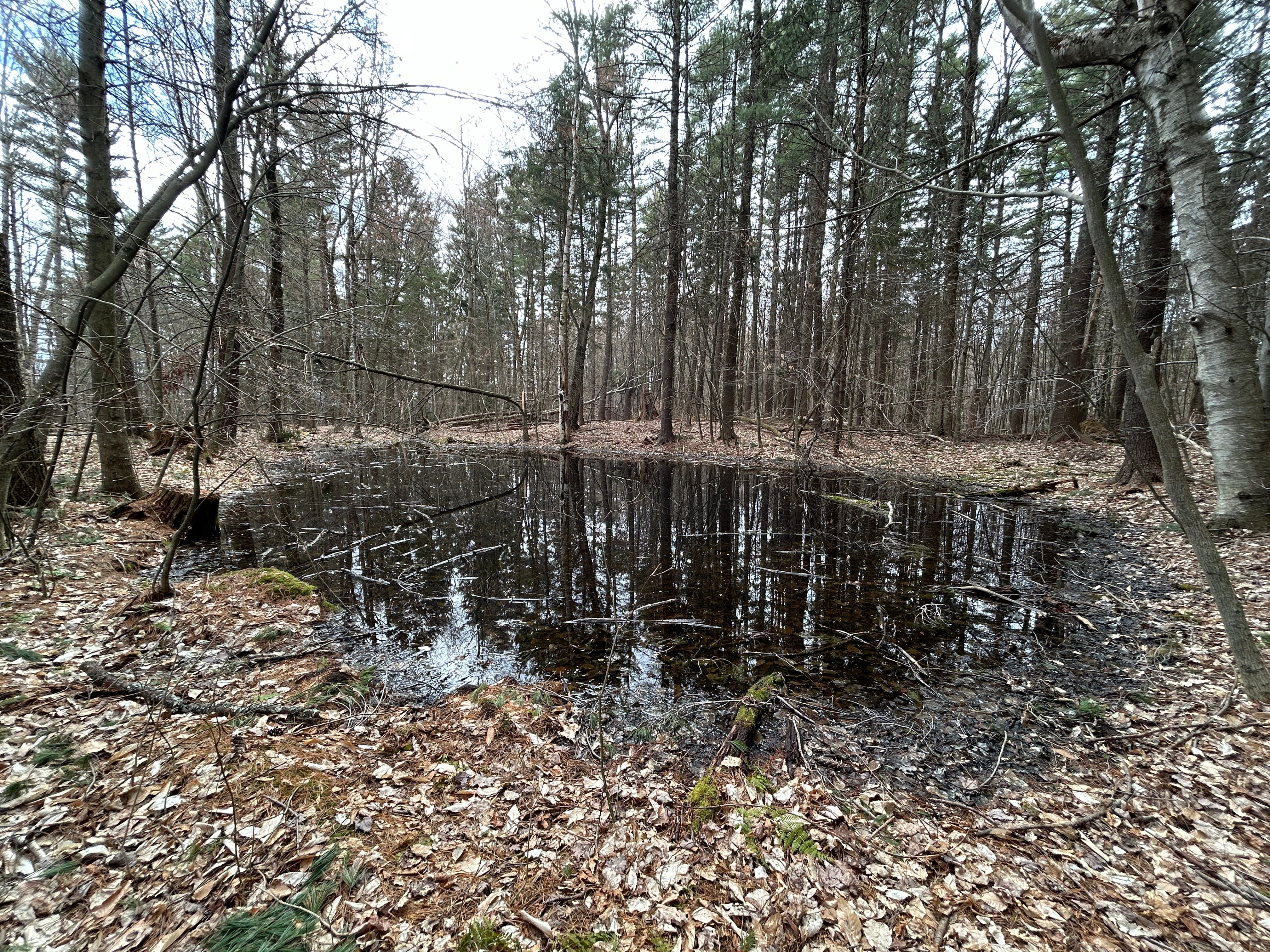
These were all near a vernal pool among the Pines near the hilltop. The pool seemed to be some sign of soil retention success.
![](https://substackcdn.com/image/fetch/w_1456,c_limit,f_auto,q_auto:good,fl_progressive:steep/https%3A%2F%2Fsubstack-post-media.s3.amazonaws.com%2Fpublic%2Fimages%2F3c3e9cf1-728f-43d2-8f31-8c24fa1f92e6_1213x766.jpeg)
There is a huge gully carved out by eroding rains that runs down the southwestern slope of the hill. The only actual stonework I found on the hill was at the base of the gully, what looked like the remnants of a gateway or a doorway.
![](https://substackcdn.com/image/fetch/w_474,c_limit,f_auto,q_auto:good,fl_progressive:steep/https%3A%2F%2Fsubstack-post-media.s3.amazonaws.com%2Fpublic%2Fimages%2Fc6ec24e0-ac56-453e-a51b-fddda52f881b_4032x3024.jpeg)
![](https://substackcdn.com/image/fetch/w_474,c_limit,f_auto,q_auto:good,fl_progressive:steep/https%3A%2F%2Fsubstack-post-media.s3.amazonaws.com%2Fpublic%2Fimages%2F68402d48-b9ef-4643-a459-0599eb3245a7_4032x3024.jpeg)
![](https://substackcdn.com/image/fetch/w_474,c_limit,f_auto,q_auto:good,fl_progressive:steep/https%3A%2F%2Fsubstack-post-media.s3.amazonaws.com%2Fpublic%2Fimages%2F1c2f604b-7b4a-4bd3-b5df-e0f1c0bb33b6_4032x3024.jpeg)
![](https://substackcdn.com/image/fetch/w_474,c_limit,f_auto,q_auto:good,fl_progressive:steep/https%3A%2F%2Fsubstack-post-media.s3.amazonaws.com%2Fpublic%2Fimages%2Fb7ca3ac2-4483-419b-af39-120e072c0095_4032x3024.jpeg)
![](https://substackcdn.com/image/fetch/w_474,c_limit,f_auto,q_auto:good,fl_progressive:steep/https%3A%2F%2Fsubstack-post-media.s3.amazonaws.com%2Fpublic%2Fimages%2Fcd555369-e0ab-475e-998b-ee531a7d342e_4032x3024.jpeg)
![](https://substackcdn.com/image/fetch/w_474,c_limit,f_auto,q_auto:good,fl_progressive:steep/https%3A%2F%2Fsubstack-post-media.s3.amazonaws.com%2Fpublic%2Fimages%2F0a8c78de-9b46-4ec7-bacb-1ccbe675c58d_4032x3024.jpeg)
Jess, the forest manager, said she'd assumed the stonework was somehow related to water control coming out of the gully above it, like a mini dam or structure to slow water flow, but she admitted that was her wild guess based on the conditions there.
I noted a rectangular recess behind the stones and thought it could have been a spring house before the gully opened up behind it and washed it out, or some other sort of small structure, or the entrance to a staircase once cut into the hillside.
![](https://substackcdn.com/image/fetch/w_1456,c_limit,f_auto,q_auto:good,fl_progressive:steep/https%3A%2F%2Fsubstack-post-media.s3.amazonaws.com%2Fpublic%2Fimages%2Fdf3e5fcf-0634-4c0e-bb32-6b25048b546a_4032x3024.jpeg)
Strangely enough, I found a number of glacial erratics along a sort of shelf midway up the western side of the hill, which is pretty steep.
The bedrock seems to break off in long spalls on this side, judging by the damage an old tree had done. So, the shelf could be natural. But one of the boulders (really two because it's split) looked to me like a possible Fish Effigy.
![](https://substackcdn.com/image/fetch/w_2400,c_limit,f_auto,q_auto:good,fl_progressive:steep/https%3A%2F%2Fsubstack-post-media.s3.amazonaws.com%2Fpublic%2Fimages%2F4b7b269f-d1f0-4cc0-821a-e0c49d5b2157_4032x3024.jpeg)
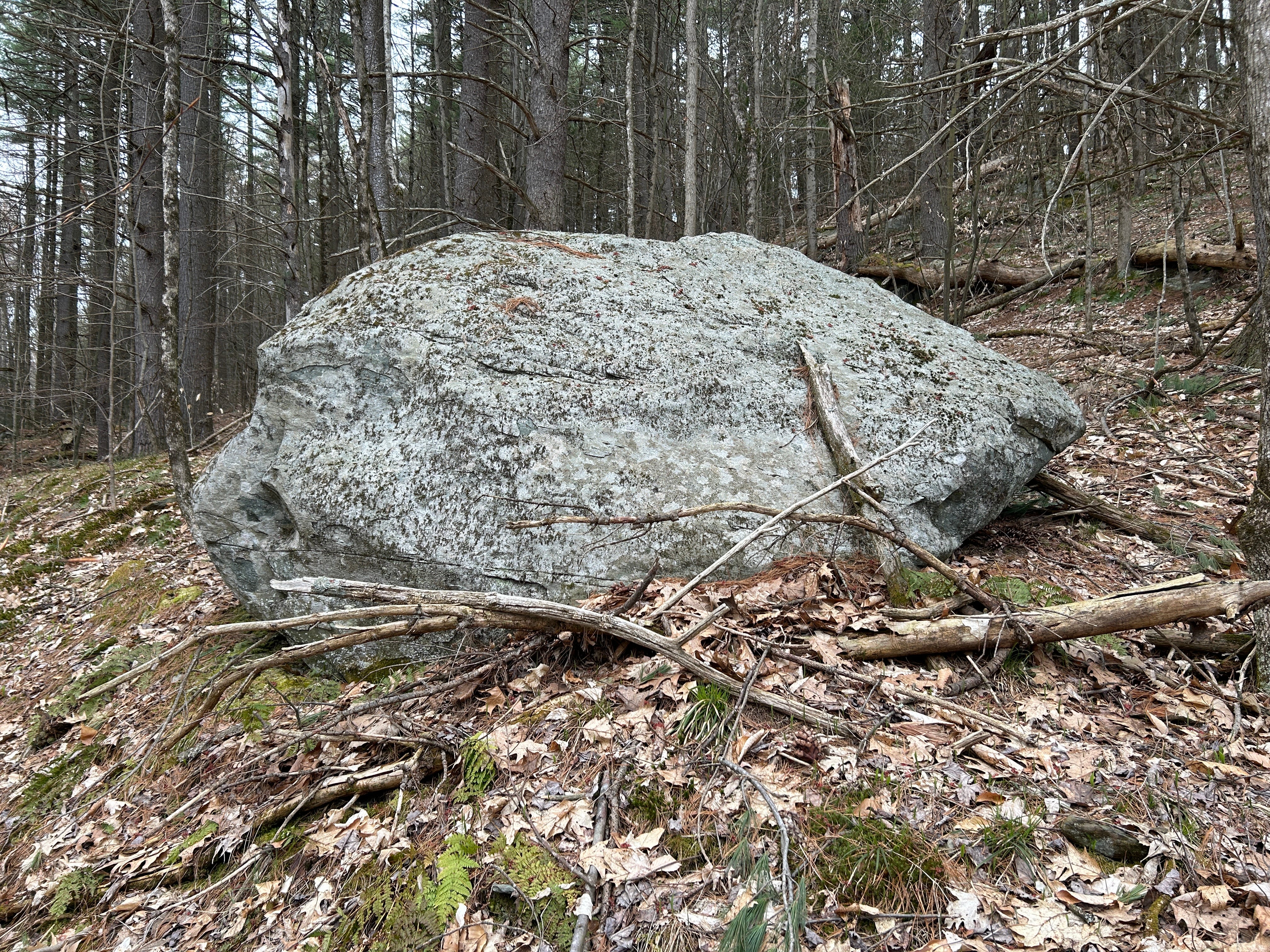
Both the tail and the front look shaped, to me, in ways I've seen stone shaped before, though my assessment would likely not be shared by some as it goes against current consensus. I base my assessment on repeated designs. I called this a possible Fish Effigy because I've seen these shapes on other boulders and stones which also seemed to be somewhat aquatic representations.
![](https://substackcdn.com/image/fetch/w_720,c_limit,f_auto,q_auto:good,fl_progressive:steep/https%3A%2F%2Fsubstack-post-media.s3.amazonaws.com%2Fpublic%2Fimages%2F9e8d6159-92c8-4ade-83c1-4c06a4ddf1cc_4032x3024.jpeg)
![](https://substackcdn.com/image/fetch/w_720,c_limit,f_auto,q_auto:good,fl_progressive:steep/https%3A%2F%2Fsubstack-post-media.s3.amazonaws.com%2Fpublic%2Fimages%2Ffed3a615-92bd-4f56-910e-6eea1bbc2937_4032x3024.jpeg)
![](https://substackcdn.com/image/fetch/w_720,c_limit,f_auto,q_auto:good,fl_progressive:steep/https%3A%2F%2Fsubstack-post-media.s3.amazonaws.com%2Fpublic%2Fimages%2F5def1f88-b491-43f7-b2f3-93c8a77ee506_4032x3024.jpeg)
![](https://substackcdn.com/image/fetch/w_720,c_limit,f_auto,q_auto:good,fl_progressive:steep/https%3A%2F%2Fsubstack-post-media.s3.amazonaws.com%2Fpublic%2Fimages%2F6822624d-256d-4681-8cc7-bb0df2408c02_4032x3024.jpeg)
For one example, a triangular Fin-like shape on this possible Fish Effigy here in Vermont, we also seem to see on King Phillip Rock in Berlin, Massachusetts, which is more than 200 miles southeast of here. I'm guessing this is the fin of a fish, but I could easily be mistaken. Still, it is a repeated pattern, a repeated design.
When we come up and around, we see the split of the stone.
![](https://substackcdn.com/image/fetch/w_474,c_limit,f_auto,q_auto:good,fl_progressive:steep/https%3A%2F%2Fsubstack-post-media.s3.amazonaws.com%2Fpublic%2Fimages%2Fe89611c5-3d16-4196-a7e9-05b08e160d50_4032x3024.jpeg)
![](https://substackcdn.com/image/fetch/w_474,c_limit,f_auto,q_auto:good,fl_progressive:steep/https%3A%2F%2Fsubstack-post-media.s3.amazonaws.com%2Fpublic%2Fimages%2Fbcf4ffd1-fcd2-4719-bad0-33ed26994e6c_4032x3024.jpeg)
![](https://substackcdn.com/image/fetch/w_474,c_limit,f_auto,q_auto:good,fl_progressive:steep/https%3A%2F%2Fsubstack-post-media.s3.amazonaws.com%2Fpublic%2Fimages%2Fae3aa023-332f-42b3-a5e4-8d5ce0494a39_4032x3024.jpeg)
![](https://substackcdn.com/image/fetch/w_720,c_limit,f_auto,q_auto:good,fl_progressive:steep/https%3A%2F%2Fsubstack-post-media.s3.amazonaws.com%2Fpublic%2Fimages%2F50dac07a-a483-4979-bd74-5552fb1453d1_4032x3024.jpeg)
![](https://substackcdn.com/image/fetch/w_720,c_limit,f_auto,q_auto:good,fl_progressive:steep/https%3A%2F%2Fsubstack-post-media.s3.amazonaws.com%2Fpublic%2Fimages%2F3d435a52-9302-4bdf-87a3-80059473ac9c_4032x3024.jpeg)
Split stones often held spiritual significance for indigenous peoples in the northeast of what's now North America.
Following the shelf, almost a terrace of a sort, leads to several other curious stones. This one with its curves and shelves was worth a walk around.
![](https://substackcdn.com/image/fetch/w_720,c_limit,f_auto,q_auto:good,fl_progressive:steep/https%3A%2F%2Fsubstack-post-media.s3.amazonaws.com%2Fpublic%2Fimages%2Fe975abf4-9258-4fd8-a8e4-ab2628a6919a_4032x3024.jpeg)
![](https://substackcdn.com/image/fetch/w_720,c_limit,f_auto,q_auto:good,fl_progressive:steep/https%3A%2F%2Fsubstack-post-media.s3.amazonaws.com%2Fpublic%2Fimages%2F31cd8213-36b4-4150-b799-d9ad3a6d0fa3_4032x3024.jpeg)
![](https://substackcdn.com/image/fetch/w_720,c_limit,f_auto,q_auto:good,fl_progressive:steep/https%3A%2F%2Fsubstack-post-media.s3.amazonaws.com%2Fpublic%2Fimages%2F9a4a0724-ef3c-4aee-b921-affd324eb0d7_4032x3024.jpeg)
![](https://substackcdn.com/image/fetch/w_720,c_limit,f_auto,q_auto:good,fl_progressive:steep/https%3A%2F%2Fsubstack-post-media.s3.amazonaws.com%2Fpublic%2Fimages%2Fb2f5dde2-a9fc-4dd6-a431-19ca398a1123_4032x3024.jpeg)
This is what that terrace or natural shelves' northern end looks like:
![](https://substackcdn.com/image/fetch/w_474,c_limit,f_auto,q_auto:good,fl_progressive:steep/https%3A%2F%2Fsubstack-post-media.s3.amazonaws.com%2Fpublic%2Fimages%2F4eb88b4c-46b7-4e28-9051-31c8cc9ac787_4032x3024.jpeg)
![](https://substackcdn.com/image/fetch/w_474,c_limit,f_auto,q_auto:good,fl_progressive:steep/https%3A%2F%2Fsubstack-post-media.s3.amazonaws.com%2Fpublic%2Fimages%2Fe7a1ee04-383f-497c-a605-31931b6b4877_4032x3024.jpeg)
![](https://substackcdn.com/image/fetch/w_474,c_limit,f_auto,q_auto:good,fl_progressive:steep/https%3A%2F%2Fsubstack-post-media.s3.amazonaws.com%2Fpublic%2Fimages%2F4f173144-cef1-4905-8775-ece0118bb292_4032x3024.jpeg)
![](https://substackcdn.com/image/fetch/w_720,c_limit,f_auto,q_auto:good,fl_progressive:steep/https%3A%2F%2Fsubstack-post-media.s3.amazonaws.com%2Fpublic%2Fimages%2Fecbd35ac-ba3f-48b3-aea9-67ca41454874_4032x3024.jpeg)
![](https://substackcdn.com/image/fetch/w_720,c_limit,f_auto,q_auto:good,fl_progressive:steep/https%3A%2F%2Fsubstack-post-media.s3.amazonaws.com%2Fpublic%2Fimages%2F0e062eda-b37f-4277-a58d-6942b458ea1a_4032x3024.jpeg)
UVM's Jericho Research Forest extends down to the south and west from the area around the hill. On return visits, I've made my way down and around some pretty old trails, not all well-used anymore — some were a bit steep, some rather wet.
I did find one somewhat interesting stone in that lower section…
![](https://substackcdn.com/image/fetch/w_474,c_limit,f_auto,q_auto:good,fl_progressive:steep/https%3A%2F%2Fsubstack-post-media.s3.amazonaws.com%2Fpublic%2Fimages%2Feee537af-1baf-4cef-b9eb-a8ce03266525_4032x3024.jpeg)
![](https://substackcdn.com/image/fetch/w_474,c_limit,f_auto,q_auto:good,fl_progressive:steep/https%3A%2F%2Fsubstack-post-media.s3.amazonaws.com%2Fpublic%2Fimages%2Fec7b078c-832d-4f13-a68a-1caba5a1629c_4032x3024.jpeg)
![](https://substackcdn.com/image/fetch/w_474,c_limit,f_auto,q_auto:good,fl_progressive:steep/https%3A%2F%2Fsubstack-post-media.s3.amazonaws.com%2Fpublic%2Fimages%2F7f4a930f-4fb0-4aa8-b1fd-57f967d46fa0_4032x3024.jpeg)
![](https://substackcdn.com/image/fetch/w_474,c_limit,f_auto,q_auto:good,fl_progressive:steep/https%3A%2F%2Fsubstack-post-media.s3.amazonaws.com%2Fpublic%2Fimages%2Fd90ced35-9f66-4175-a1c5-40fab29ad06b_4032x3024.jpeg)
![](https://substackcdn.com/image/fetch/w_474,c_limit,f_auto,q_auto:good,fl_progressive:steep/https%3A%2F%2Fsubstack-post-media.s3.amazonaws.com%2Fpublic%2Fimages%2F95356c9f-1724-49df-9349-cee53c8d280b_4032x3024.jpeg)
![](https://substackcdn.com/image/fetch/w_474,c_limit,f_auto,q_auto:good,fl_progressive:steep/https%3A%2F%2Fsubstack-post-media.s3.amazonaws.com%2Fpublic%2Fimages%2F71b3c1f7-7f22-4952-bc58-8e9caecf3d62_4032x3024.jpeg)
![](https://substackcdn.com/image/fetch/w_720,c_limit,f_auto,q_auto:good,fl_progressive:steep/https%3A%2F%2Fsubstack-post-media.s3.amazonaws.com%2Fpublic%2Fimages%2Fa811c26c-710a-427e-94ec-3a64b8ae7692_4032x3024.jpeg)
![](https://substackcdn.com/image/fetch/w_720,c_limit,f_auto,q_auto:good,fl_progressive:steep/https%3A%2F%2Fsubstack-post-media.s3.amazonaws.com%2Fpublic%2Fimages%2Fd39ee29b-6764-408d-a69b-69a58234651c_4032x3024.jpeg)
Could this stone have been perched, placed here deliberately?
The ridge on the way from the hill down towards the southwestern section showed some very interesting — speculative stonework, including a perched wing-shaped stone. Though not in an alcove, this is at the height I've found what I've termed perched wing-shaped stones in alcoves, which could date back to the glacial lakes.
![](https://substackcdn.com/image/fetch/w_720,c_limit,f_auto,q_auto:good,fl_progressive:steep/https%3A%2F%2Fsubstack-post-media.s3.amazonaws.com%2Fpublic%2Fimages%2F4d44a545-708c-4fc7-afad-81e6c8811fee_3684x2400.png)
![](https://substackcdn.com/image/fetch/w_720,c_limit,f_auto,q_auto:good,fl_progressive:steep/https%3A%2F%2Fsubstack-post-media.s3.amazonaws.com%2Fpublic%2Fimages%2F2136d74b-9c57-420e-882f-a4ce820ef31e_4032x3024.jpeg)
My video from last year on the Saint Albans Town Forest has more about that potential wing-shaped stone form:
This wing-shaped stone first caught my eye as a possible stood-up stone as I saw it side-on from a distance.
![](https://substackcdn.com/image/fetch/w_1456,c_limit,f_auto,q_auto:good,fl_progressive:steep/https%3A%2F%2Fsubstack-post-media.s3.amazonaws.com%2Fpublic%2Fimages%2Fb1849a14-e11d-44dd-8cfd-14516d85d312_4032x3024.jpeg)
I believe this wing-shaped stone could have been perched in place here with these other stones around it, possibly to create the appearance of an underground great serpent breaking through.
It's possible they saw this entire small ridge this way, as evoking the form of a great serpent.
![](https://substackcdn.com/image/fetch/w_474,c_limit,f_auto,q_auto:good,fl_progressive:steep/https%3A%2F%2Fsubstack-post-media.s3.amazonaws.com%2Fpublic%2Fimages%2F242a19c4-2c5f-45a4-89c0-2db474c37d7b_4032x3024.jpeg)
![](https://substackcdn.com/image/fetch/w_474,c_limit,f_auto,q_auto:good,fl_progressive:steep/https%3A%2F%2Fsubstack-post-media.s3.amazonaws.com%2Fpublic%2Fimages%2F886c21af-c1a8-4c29-80a3-ed0c07d4c5ea_4032x3024.jpeg)
![](https://substackcdn.com/image/fetch/w_474,c_limit,f_auto,q_auto:good,fl_progressive:steep/https%3A%2F%2Fsubstack-post-media.s3.amazonaws.com%2Fpublic%2Fimages%2Ffc06ac18-7b09-4c48-917a-dc7acc00e608_4032x3024.jpeg)
![](https://substackcdn.com/image/fetch/w_474,c_limit,f_auto,q_auto:good,fl_progressive:steep/https%3A%2F%2Fsubstack-post-media.s3.amazonaws.com%2Fpublic%2Fimages%2F8c7a62f9-2444-416d-9483-09ea8467899d_4032x3024.jpeg)
![](https://substackcdn.com/image/fetch/w_474,c_limit,f_auto,q_auto:good,fl_progressive:steep/https%3A%2F%2Fsubstack-post-media.s3.amazonaws.com%2Fpublic%2Fimages%2Fb304a143-3310-4bc1-a93d-bc16a7498666_4032x3024.jpeg)
![](https://substackcdn.com/image/fetch/w_474,c_limit,f_auto,q_auto:good,fl_progressive:steep/https%3A%2F%2Fsubstack-post-media.s3.amazonaws.com%2Fpublic%2Fimages%2F2bacde9b-e235-479e-af9d-3e474a065d27_4032x3024.jpeg)
![](https://substackcdn.com/image/fetch/w_474,c_limit,f_auto,q_auto:good,fl_progressive:steep/https%3A%2F%2Fsubstack-post-media.s3.amazonaws.com%2Fpublic%2Fimages%2F5850c511-6580-4328-8100-bba14a13020c_4032x3024.jpeg)
![](https://substackcdn.com/image/fetch/w_474,c_limit,f_auto,q_auto:good,fl_progressive:steep/https%3A%2F%2Fsubstack-post-media.s3.amazonaws.com%2Fpublic%2Fimages%2F5dc8b5d7-2377-47a4-a104-98f46ea22c58_4032x3024.jpeg)
![](https://substackcdn.com/image/fetch/w_474,c_limit,f_auto,q_auto:good,fl_progressive:steep/https%3A%2F%2Fsubstack-post-media.s3.amazonaws.com%2Fpublic%2Fimages%2F3fb3cf73-3ded-46c7-9f2f-4bbebe38e139_4032x3024.jpeg)
This end of the ridge could be the serpent's head lying down on the landscape…
![](https://substackcdn.com/image/fetch/w_2400,c_limit,f_auto,q_auto:good,fl_progressive:steep/https%3A%2F%2Fsubstack-post-media.s3.amazonaws.com%2Fpublic%2Fimages%2Ffd6e103e-9cf1-421a-8cea-32d2938f62b6_1920x1080.jpeg)
Around the other side of the ridge, we find a great deal of collapsed stone. If there was anything here, like an old rockshelter, it's likely buried under additional collapse by now.
I did find a curious perched wing-shaped stone towards the southern end of the lower ridge, but again with all the collapse here, it's hard to say this isn't natural. But I have my suspicions.
![](https://substackcdn.com/image/fetch/w_474,c_limit,f_auto,q_auto:good,fl_progressive:steep/https%3A%2F%2Fsubstack-post-media.s3.amazonaws.com%2Fpublic%2Fimages%2F0a0a1f30-c3a1-4e5c-9e77-571878ad6370_4032x3024.jpeg)
![](https://substackcdn.com/image/fetch/w_474,c_limit,f_auto,q_auto:good,fl_progressive:steep/https%3A%2F%2Fsubstack-post-media.s3.amazonaws.com%2Fpublic%2Fimages%2F87c6731b-8cff-48b5-abd1-b6d0efdf8cd0_4032x3024.jpeg)
![](https://substackcdn.com/image/fetch/w_474,c_limit,f_auto,q_auto:good,fl_progressive:steep/https%3A%2F%2Fsubstack-post-media.s3.amazonaws.com%2Fpublic%2Fimages%2Fd01d11a1-6d55-4678-a1d2-74a19e3c4588_4032x3024.jpeg)
There were curious stones nearby as well, a possible manitou stone, as you approached the ridge.
Much of this is highly speculative, but I do wonder, could any of this be ancient stonework?
There are also several glacial erratics on top of the ridge.
![](https://substackcdn.com/image/fetch/w_474,c_limit,f_auto,q_auto:good,fl_progressive:steep/https%3A%2F%2Fsubstack-post-media.s3.amazonaws.com%2Fpublic%2Fimages%2Fc19014ad-52b3-44bb-a3e2-43d285427fdb_4032x3024.jpeg)
![](https://substackcdn.com/image/fetch/w_474,c_limit,f_auto,q_auto:good,fl_progressive:steep/https%3A%2F%2Fsubstack-post-media.s3.amazonaws.com%2Fpublic%2Fimages%2Ffb57302e-758a-4777-a951-22626ece9768_4032x3024.jpeg)
![](https://substackcdn.com/image/fetch/w_474,c_limit,f_auto,q_auto:good,fl_progressive:steep/https%3A%2F%2Fsubstack-post-media.s3.amazonaws.com%2Fpublic%2Fimages%2F966632ba-b6cb-495c-908f-6159b722de07_4032x3024.jpeg)
![](https://substackcdn.com/image/fetch/w_474,c_limit,f_auto,q_auto:good,fl_progressive:steep/https%3A%2F%2Fsubstack-post-media.s3.amazonaws.com%2Fpublic%2Fimages%2Faa318f59-ccbf-4d08-8765-96f953e63df5_4032x3024.jpeg)
![](https://substackcdn.com/image/fetch/w_474,c_limit,f_auto,q_auto:good,fl_progressive:steep/https%3A%2F%2Fsubstack-post-media.s3.amazonaws.com%2Fpublic%2Fimages%2Fabb63585-17f6-4343-9f83-474616f463c4_4032x3024.jpeg)
![](https://substackcdn.com/image/fetch/w_474,c_limit,f_auto,q_auto:good,fl_progressive:steep/https%3A%2F%2Fsubstack-post-media.s3.amazonaws.com%2Fpublic%2Fimages%2F608a56ca-a079-4b70-ae1a-2620bb7d9dde_4032x3024.jpeg)
![](https://substackcdn.com/image/fetch/w_720,c_limit,f_auto,q_auto:good,fl_progressive:steep/https%3A%2F%2Fsubstack-post-media.s3.amazonaws.com%2Fpublic%2Fimages%2F4f2a535b-2445-49df-ba40-e6bd61b91c23_4032x3024.jpeg)
![](https://substackcdn.com/image/fetch/w_720,c_limit,f_auto,q_auto:good,fl_progressive:steep/https%3A%2F%2Fsubstack-post-media.s3.amazonaws.com%2Fpublic%2Fimages%2F26455ec1-a1af-4977-a3fb-5b30805f0234_4032x3024.jpeg)
This stone looks perched at first, but it's not. There's a gap between the boulder and the lower stone, not perched in this case.
There's a lot to take in here in the UVM Jericho Research Forest, as you can tell. Still more for me to explore! I will be back. And just to be clear, I'm an independent investigator, and this post has nothing whatsoever to do with UVM — the University of Vermont. I do owe my thanks again to UVM Forest Manager Jess Wikle for her help and interest, as well as the information and old photos and schematic she shared and allowed me to share with you.
Thank you for joining me in Experiencing these Mysterious Earthworks, Odd Boulders, and More in UVM's Jericho Research Forest.