


Rock of King
Glacial Erratic? Perched Boulder? Shaped Stone? Searching Out King Philip Rock in Berlin, Massachusetts


Wampanoag Satchem Metacom was called King Philip by Europeans who knew him and knew of him. He was a son of Massassoit, the Indigenous Leader who had welcomed the Pilgrims and helped them survive through their first winters. Metacom saw that the sons of those first Europeans were not keeping their fathers’ promises. This soon led to a bloody conflict, a war much later named for Metacom.
I’m currently reading “Our Beloved Kin…” — A New History of King Philip’s War by Lisa Brooks, as she reframes the story from both an indigenous and a woman’s perspective. Brooks observes Wampanoag land was steadily being encroached upon or taken. And European men didn’t recognize nor respect Women Leaders among the Indigenous Peoples, undermining their authority and making land deals with their wayward sons and husbands.
Metacom — as King Philip — is credited with leading an ultimately unsuccessful Indigenous war against the encroaching English colonists. And one of his meeting spots was said to be a great boulder on a hill south of Gates Pond in Berlin, Massachusetts.
Yes, that Gates Pond. There’s a 10-part series on it — Rediscovering Kequagansett — right here on my Substack.

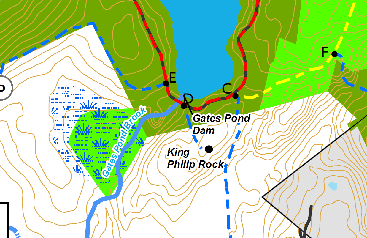
My explorations had previously concentrated on the North end of the pond. In December, having started to read Brooks’ book, I headed back to Gates Pond to see if I could find King Philip Rock there, on the pond’s southern end.
According to the Berlin Town Trail Guide:
“Another fascinating historic spot is King Philip Rock, a huge, erratic boulder 14’ high and 25’ long. Danford Tyler, a Princeton archeology graduate, called the rock ke-kaus-a-ganset (place by the Big Rock) and it was a landmark meeting place for Native Americans where he claimed in 1674 King Philip rallied his warriors there between attacks on Marlborough and then Lancaster.”
There might be something sort of correct in there... The name ke-kaus-a-ganset is close, although, according to one 19th century history of Berlin, not just this rock but the entire area, the pond and its surroundings, were known as Kequasagansett. And? The war didn’t start until 1675, and serious raids on Lancaster and Marlborough didn’t occur until early 1676, as far as I’m aware. The 1674 date would simply appear to be a mistake.
So… did King Philip really use this rock as a “landmark meeting place”? Or was the name wishful thinking? Perhaps a PR ploy in the latter days of the 19th century when this pond was a Place to Be? Did you know, there are other King Philip Rocks around this part of Massachusetts? Curious.
Maybe Metacom really did rally his warriors here. I don’t know that we can know for sure. There must be a strong local tradition which said he did. But I don’t think we can rely on the town’s Trail Guide as any sort of expert witness.
In all likelihood, this Rock was a significant meeting place for Indigenous Peoples and their leaders over the centuries, and we hear echoes of that in its name.
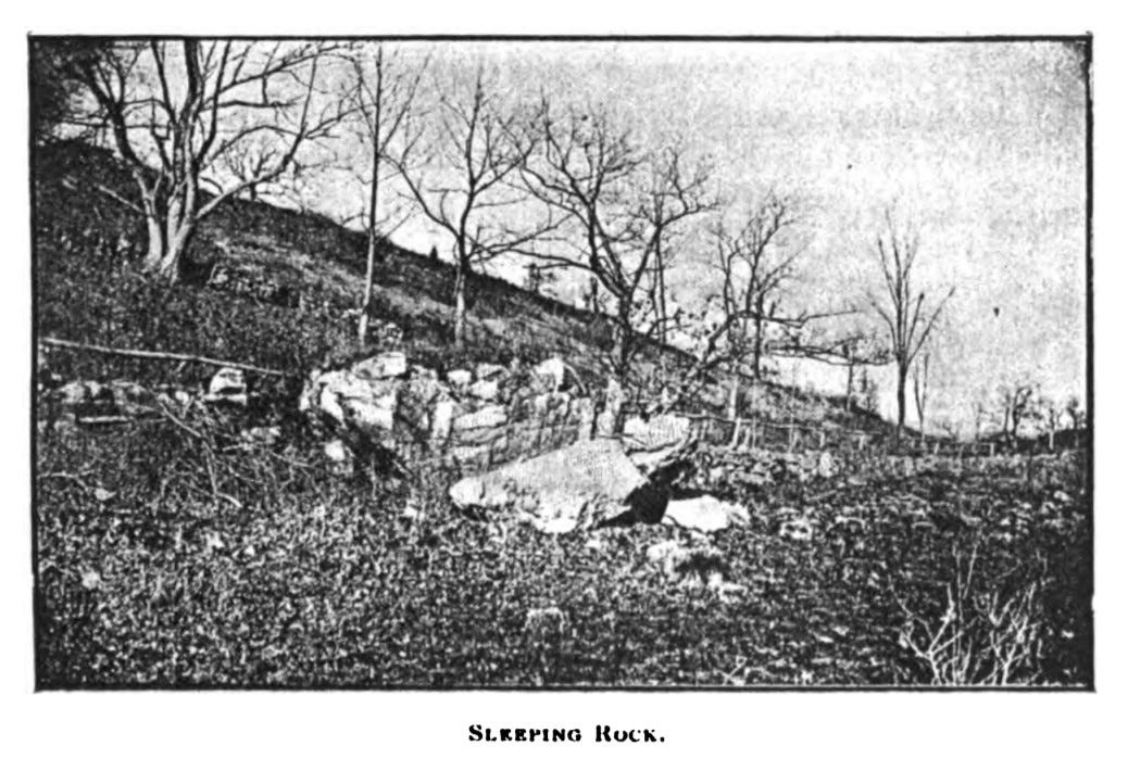
It should be noted — there was a significant, named boulder north of the pond as well, an “Indian Stone” called Sleeping Rock, which local tradition held was an overnight camping spot for traveling Indigenous folks. It would appear that, for Indigenous Peoples, this was a place of Big Stones, plural.
While I don’t think we can say with specificity that Metacom was here, it’s not out of the question.
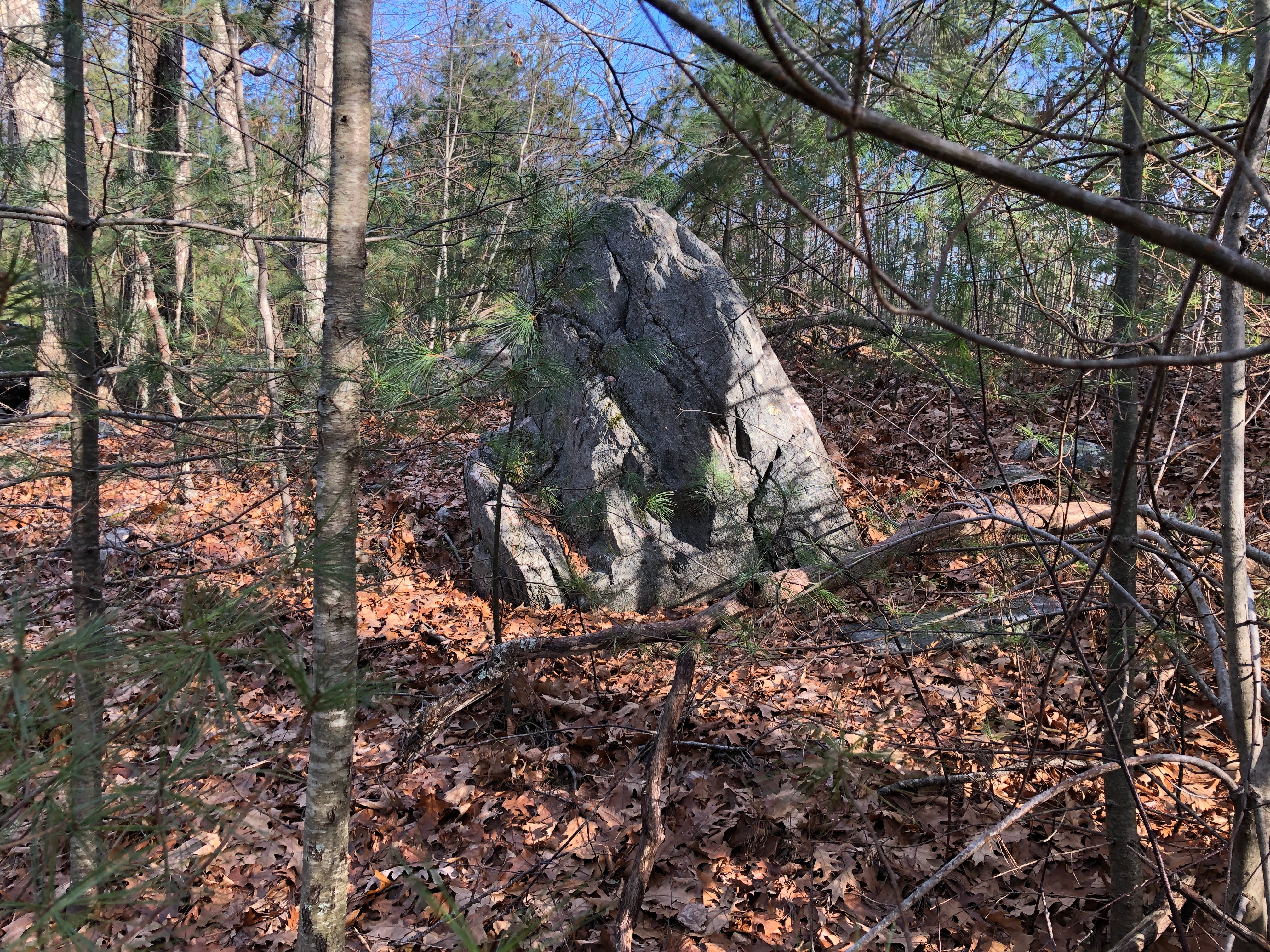
The stone is perched just off the crest of the hill south of the pond, and there is a bit of a hollow in the space in front of the boulder on the south side, where folks could have gathered to look up at someone at the boulder. The northern side of the hill “behind” the boulder featured scattered stones, including a possible perched smaller boulder, which all seemed to be oriented uphill towards the larger stone.
Which was a good thing! The trails at Gates Pond are not that well marked, aside from the many signs telling dog and horse owners to clean up after their animals’ defecation.

Once I found my way around the pond to the proper side trail (using Google Maps and referencing the trail map), I followed the stones on the north side of the hill up to find my way to King Philip Rock.

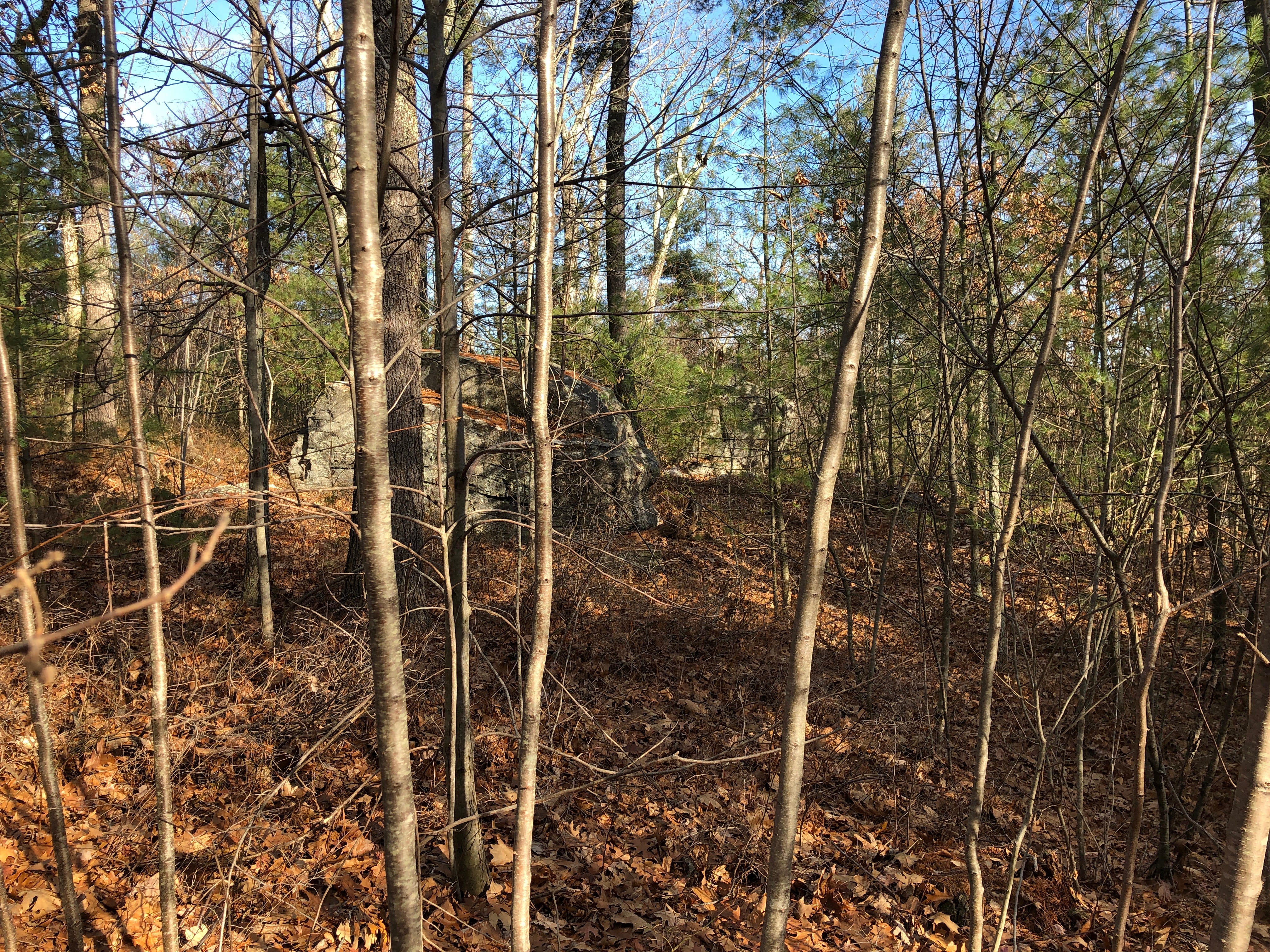
Keeping consistent, I found there to be no sign, nor commemorative plaque, nor a kiosk. But there really wasn’t a question when I reached the big stone — this was King Philip Rock!

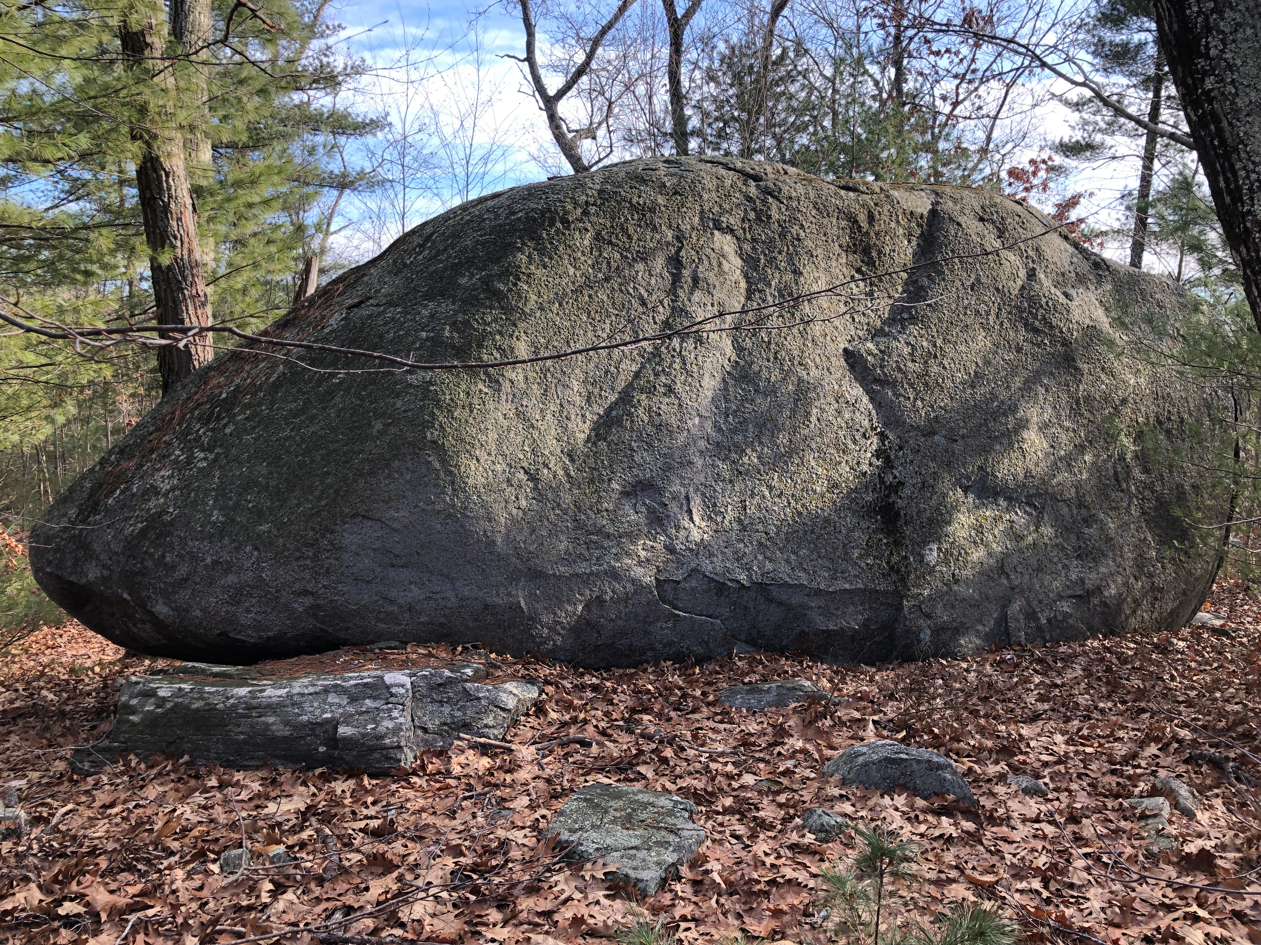
It struck me to be about 15 feet high, and easily over 20 feet long, about four feet across on each end, thicker in the middle. I didn’t measure it, simply eyeballed the size (the trail guide says it’s 14’ high and 25’ long).
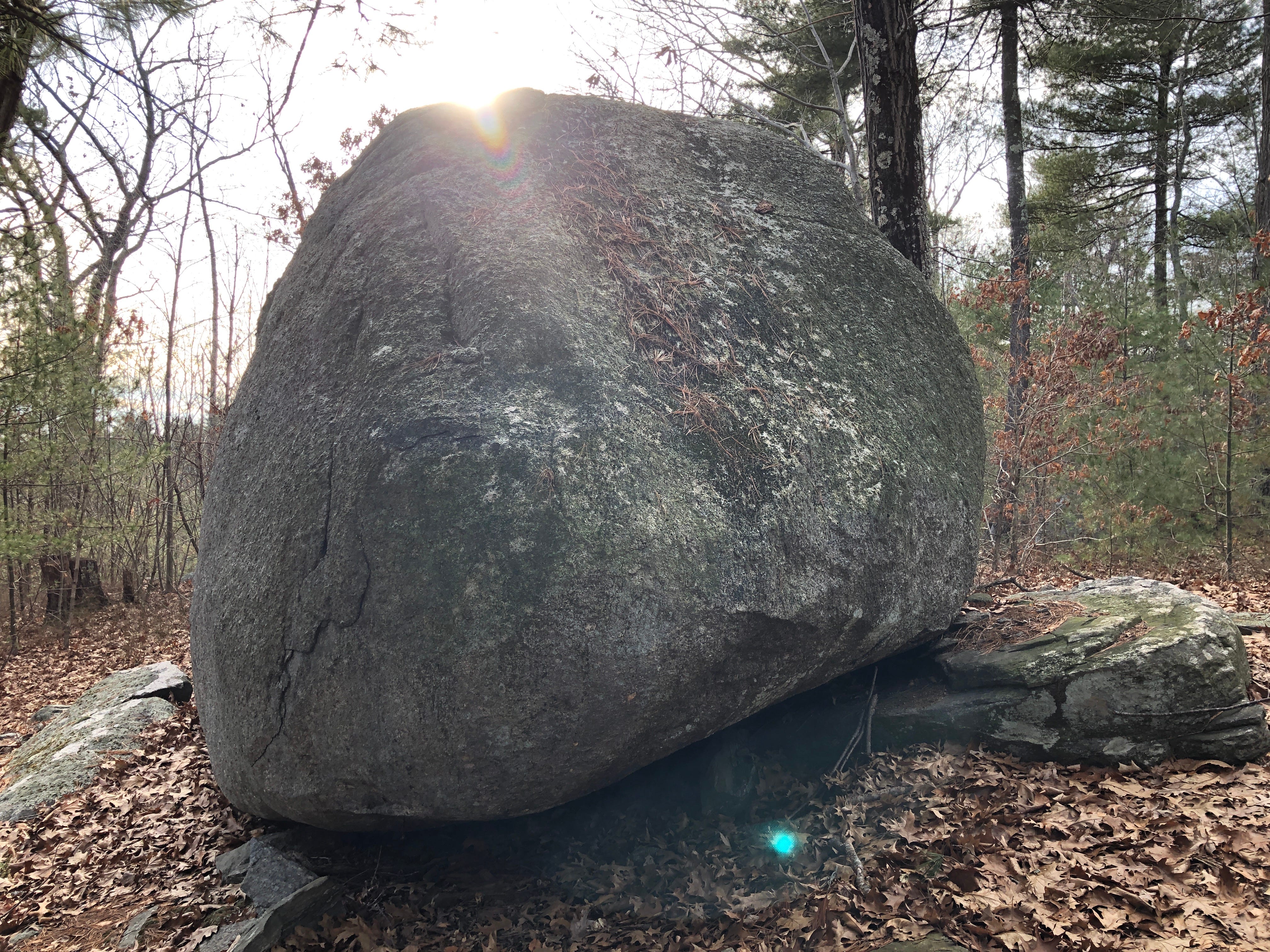
Situated just slightly over the crest of the hill, it seemed to lean slightly back into place to stand upright, almost as if perched up on its side. With the scrub and trees cleared from this hill, this boulder could have been a prominent landmark, especially from the south. The Assabet River lies south not far from here.

A small oval-shaped hollow below the boulder on the southern slope could have provided a potential gathering space. It has the look of a meeting place, if nothing else.

Looking closer at the boulder itself, there seem to be aquatic shapes worked out of the stone, so that it suggests a fish or perhaps a whale. Perhaps.

To be sure, these sorts of markings are sometimes dismissed as simply the work of nature, of glaciers or erosion, with any “design” chalked up to the mind of the observer indulging in pareidolia. I usually argue against such easy dismissals. Geology explains too much away in North America.
In my opinion? Geology needs de-colonizing. Too many of its hypotheses were agreed upon at a time when North America was thought to have been a pristine wilderness prior to European arrival.
It was not.
A population of millions ranged over the continent in the course of well over 10,000 years. To suggest human alteration to the landscape has only occurred over the last 300 years is counter to reality and finds on the ground.
One local example — they found a 4000 year-old Indigenous stone row when excavating an even older Rockshelter in Flagg Swamp about a mile southeast of here, up the hill on the other side of the Assabet River. The earliest known stone structure in Massachusetts — and ancient, archaeological proof Indigenous Peoples in this vicinity worked with stone.
There don’t seem to be any truly definitive forms here, however. Do you see any possible effigy forms in the stone?
I spent some time contemplating the stone and its setting; looking at the curious shape of it, possible shapes in its surface. Wondering if Metacom — King Philip — had actually used this rock as a meeting place at some point in time. Trying to stay warm in the frigid wind out of the northwest, which had me dreading my return walk north to along the pond to the parking area.
Part of me almost hoped I wouldn’t find any more interesting stone work on that windy walk back along the eastern edge of Gates Pond. But of course I did. More on that another time.