


Time Travelling
A December 2020 Visit to Gates Pond Paved the Way For Future Investigations

The Stones in the Woods
When you begin to “listen” to the rocks and stones, to “Let the Landscape Speak” as retired Narragansett Deputy Tribal Historic Preservation Officer Doug Harris has shared, you begin noticing the stones around you in a new light. Driving can even become hazardous, if you live in an area where old stone rows line the roads and their presence now distracts you.
Taking all precautions possible at the time, I’d headed down to finally see my Mom after the pandemic year in December of 2020. I’d avoided COVID only to nearly go off the very winding Gates Pond Road when almost back to my childhood home, as I saw the extensive old stonework along the road in a new light.
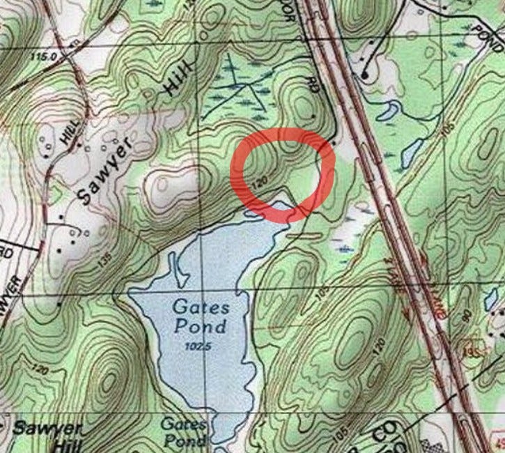
That property along Gates Pond Road is all Posted, but I knew Highway 495 lay beyond the hill, and beyond the highway was the actual Gates Pond, with public land around it. Where I could go. I’d been there as a child, once or twice.
At first, I thought it was in my hometown of Hudson, but discovered it’s over the border. Gates Pond was a Water Supply Source for the Town of Hudson, but it’s actually in Berlin, Massachusetts.
Over that holiday, I Googled about stonework at Gates Pond and discovered Peter Waksman had detailed his visits there ten years prior on his renowned Rock Piles blog, back in March of 2011. Wanting to find things on my own to some degree, I looked at the map and gave the posts a light reading, with no attempt to commit anything to deep memory, and headed for the pond a couple of days after Christmas.
When I arrived at the pond, it wasn’t really what I’d remembered in my mind’s eye. And — by design — I wasn’t clearly recalling the maps and accounts from Rock Piles in any detail.
I had no idea where I was going.
There was a longer road from Parking to the Pond than expected. When I finally reached the pond and the trail which looped around it, I decided to go counter-clockwise, and headed towards the right.
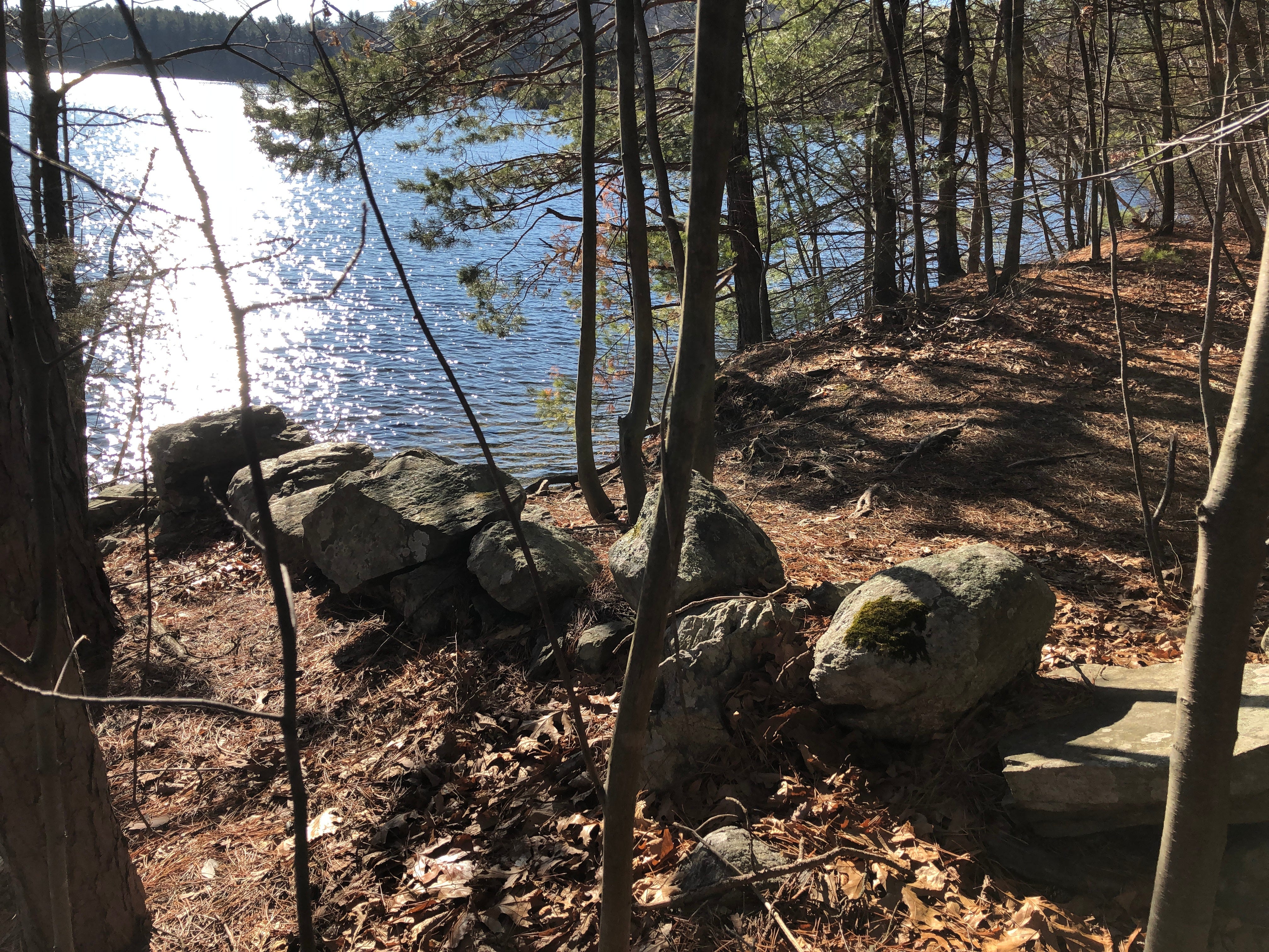
Walking around the northern tip of the pond, I spotted the beginning of a stone row on the right, in the woods. I remembered vaguely that Waksman had found stonework north of the pond, so I decided to check out this stone row and see where it led (it wasn’t in actuality anywhere near anything he’d detailed on his blog, though I didn’t know that at the time).
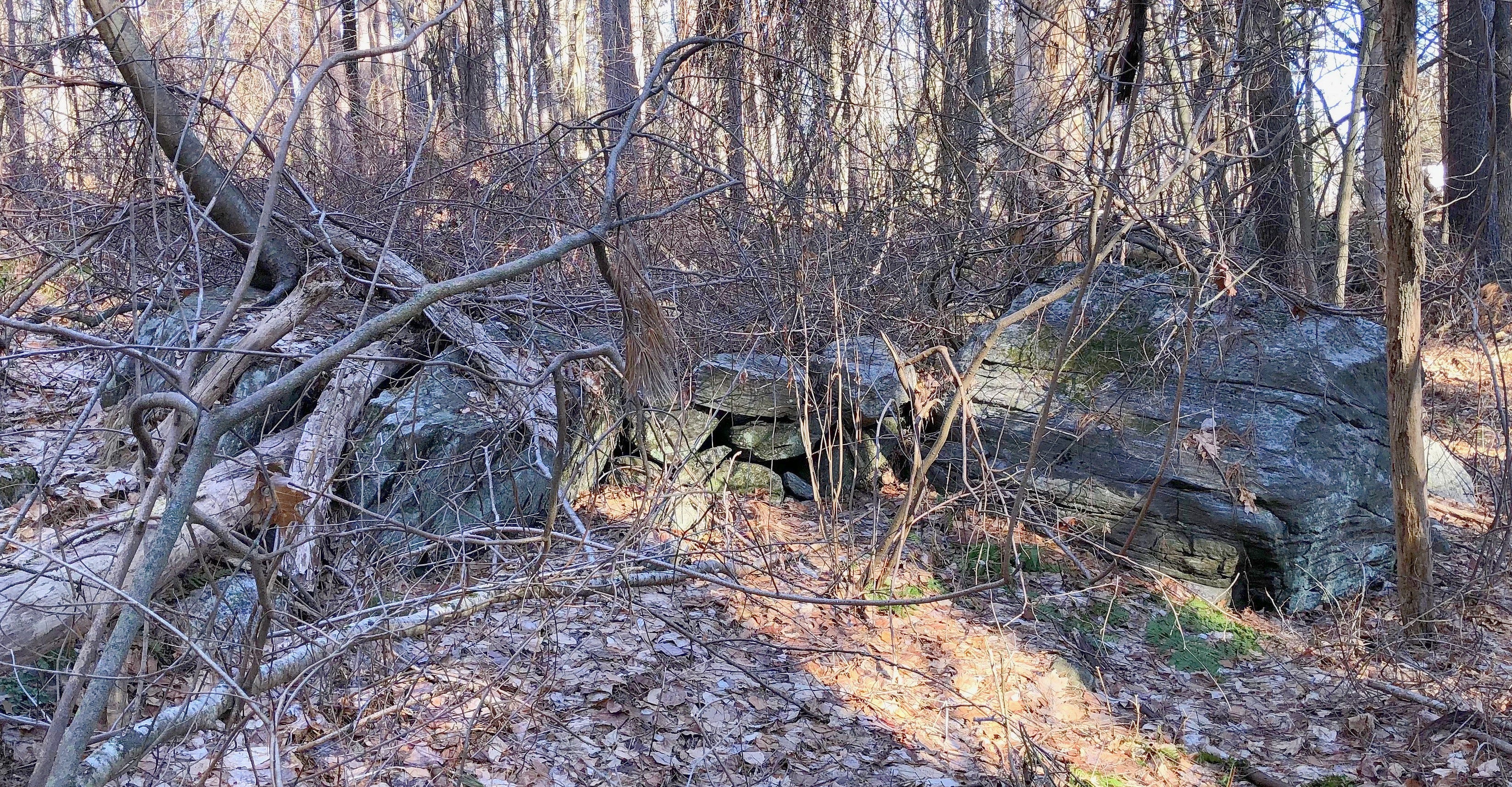
The stone row ran right along the edge of the wetland, alongside a stream flowing down from the north into the pond. The stone row wasn't straight, but shifted with the wetland, and subtly zigged and zagged in spots.
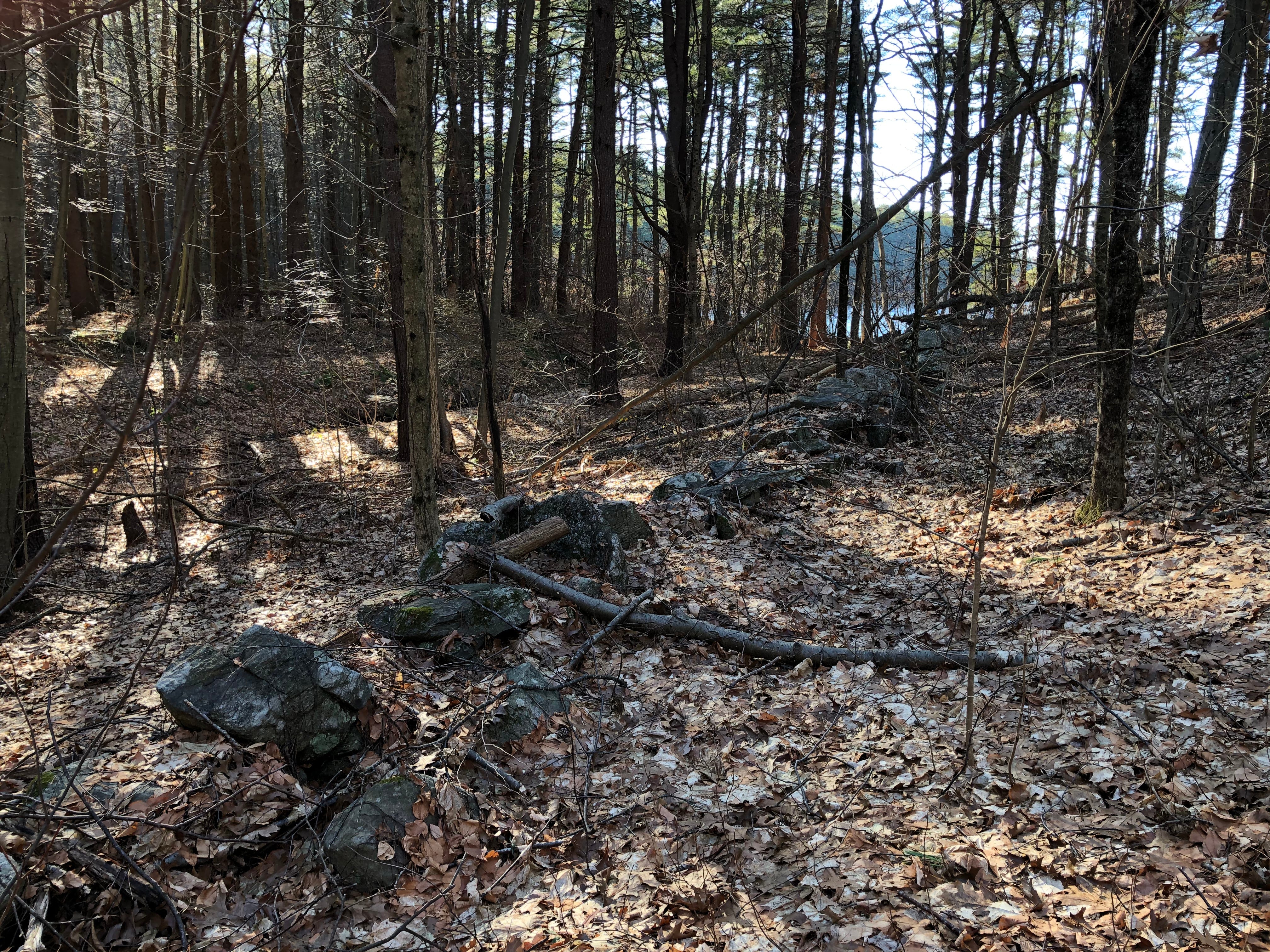
Another stone row ran parallel to this one a few hundred yards west, slightly uphill. That stone row appeared newer and more continuously intact than this lower one, which occasionally disappeared beneath the leaves and moss.
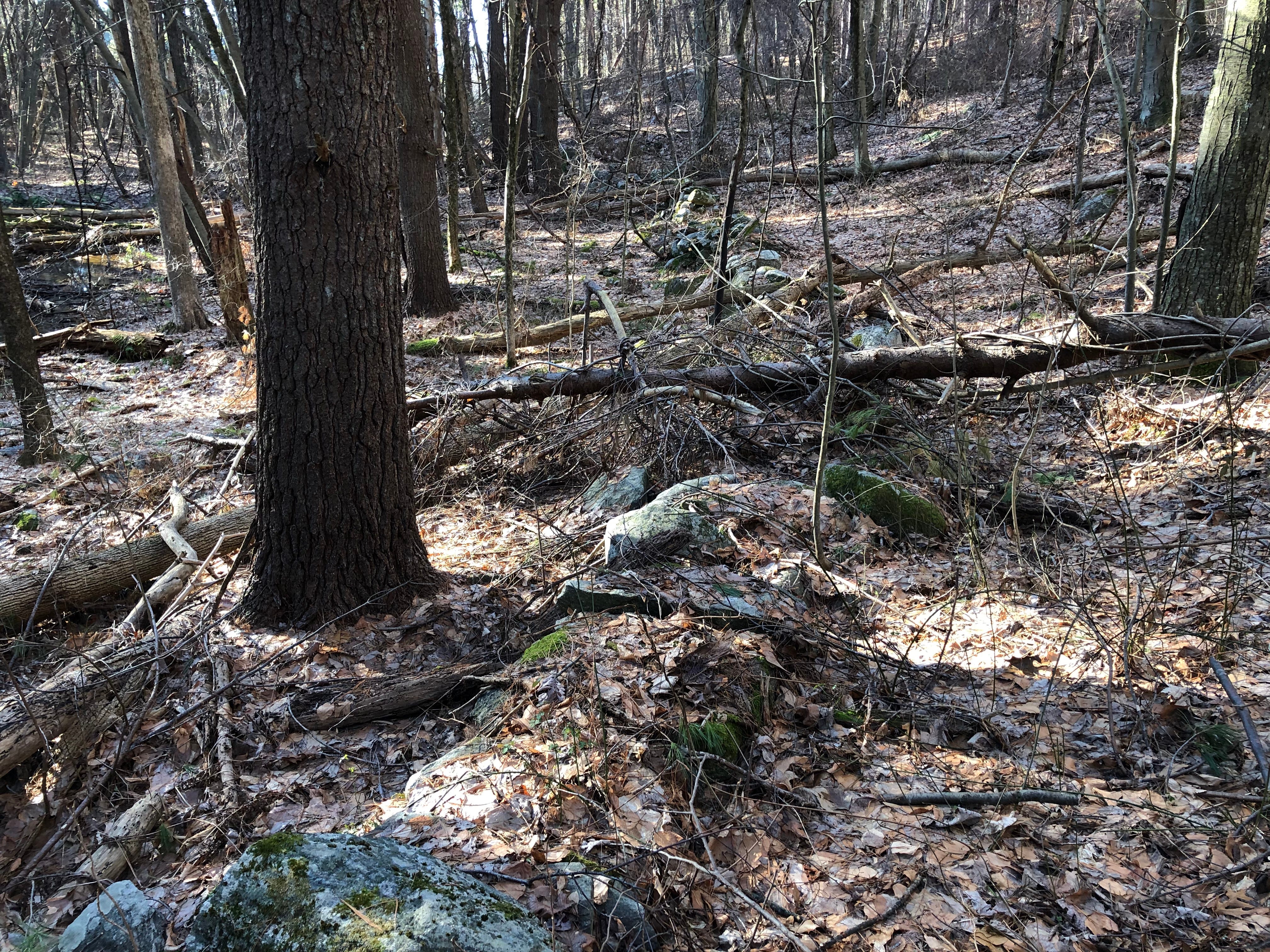
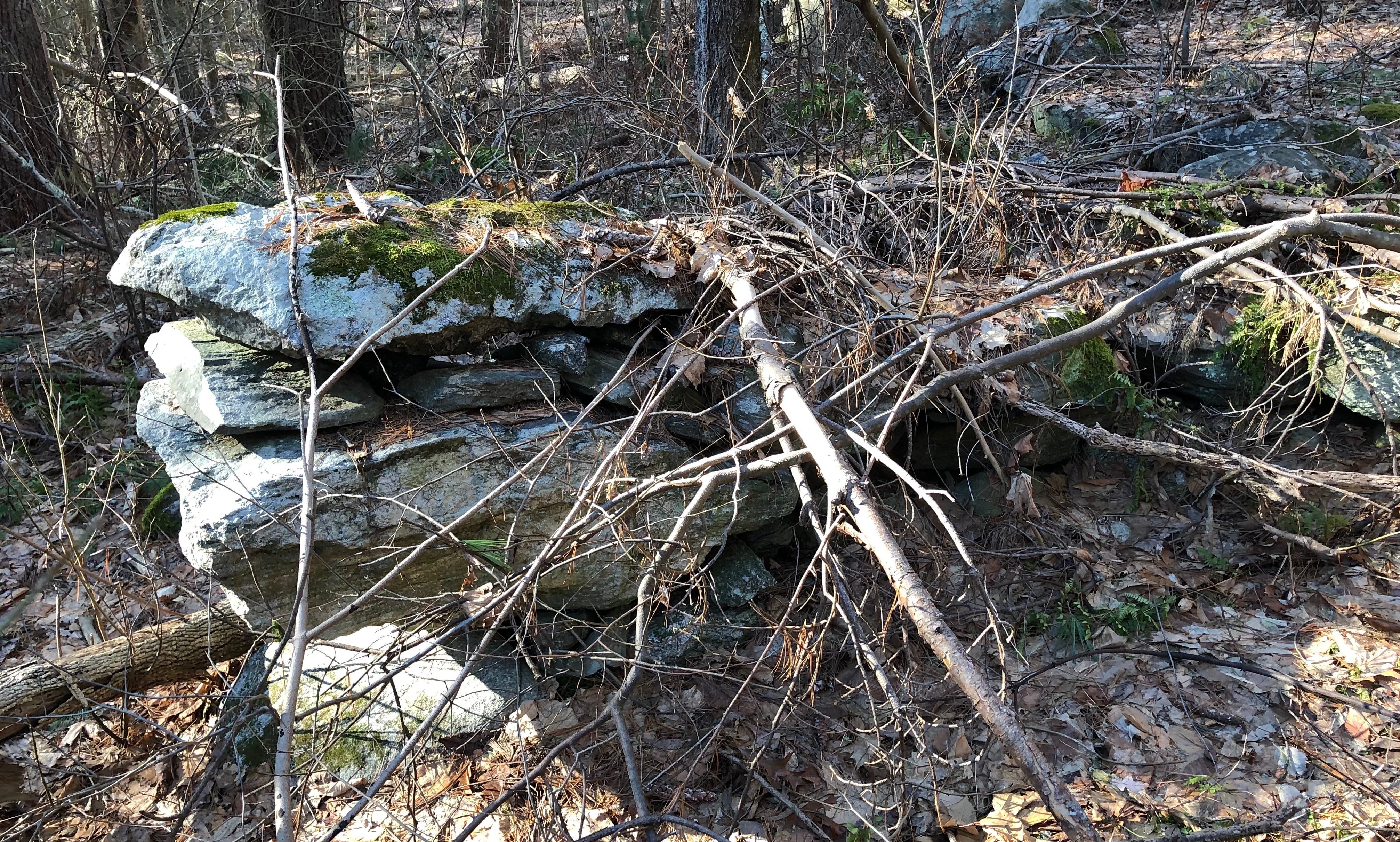
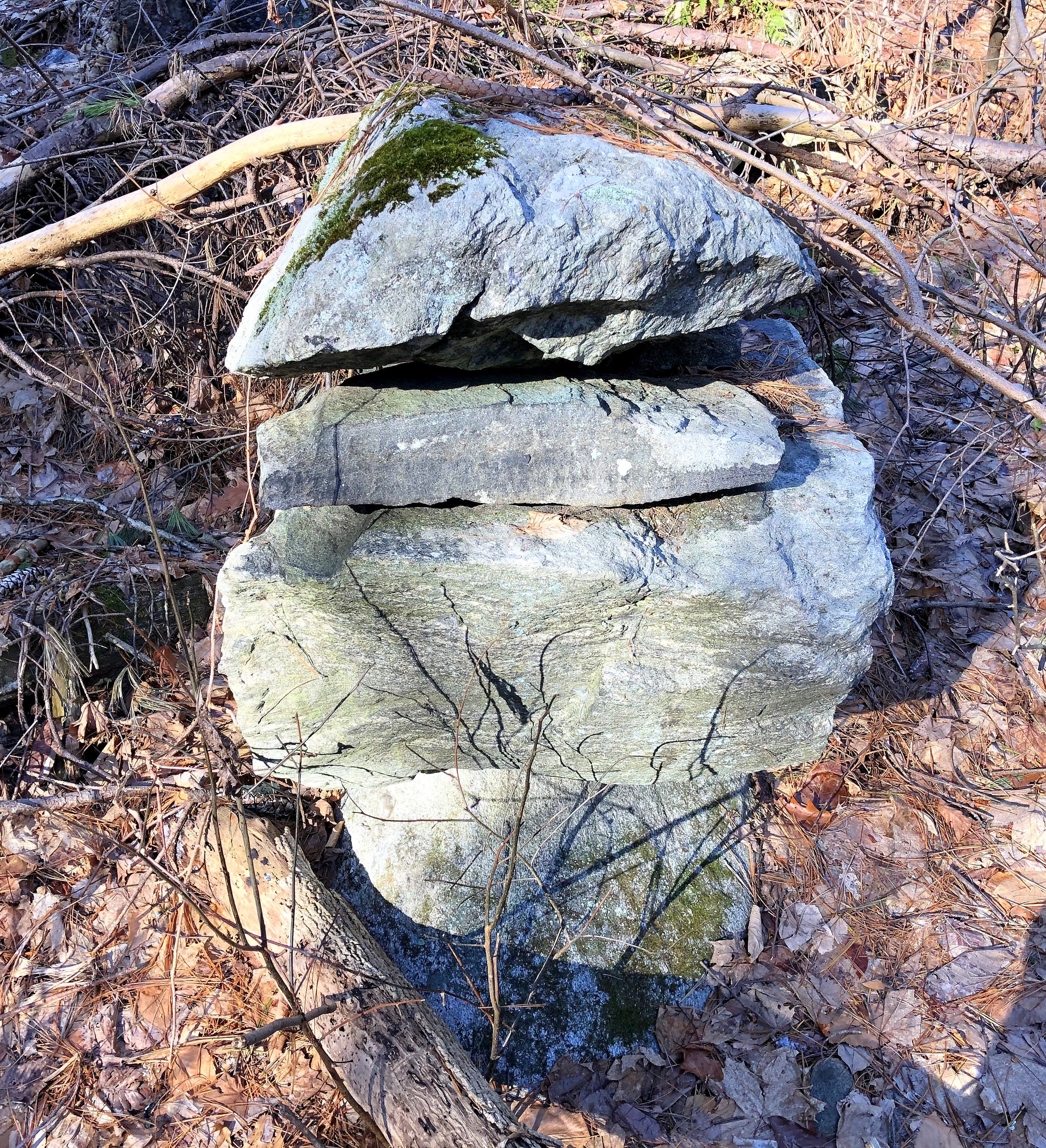
As the older stone row rose towards a right-hand turn to the east and its end, it grew, with larger stones and more complexity in its design. It ended in a complex head turned in toward the wetland.
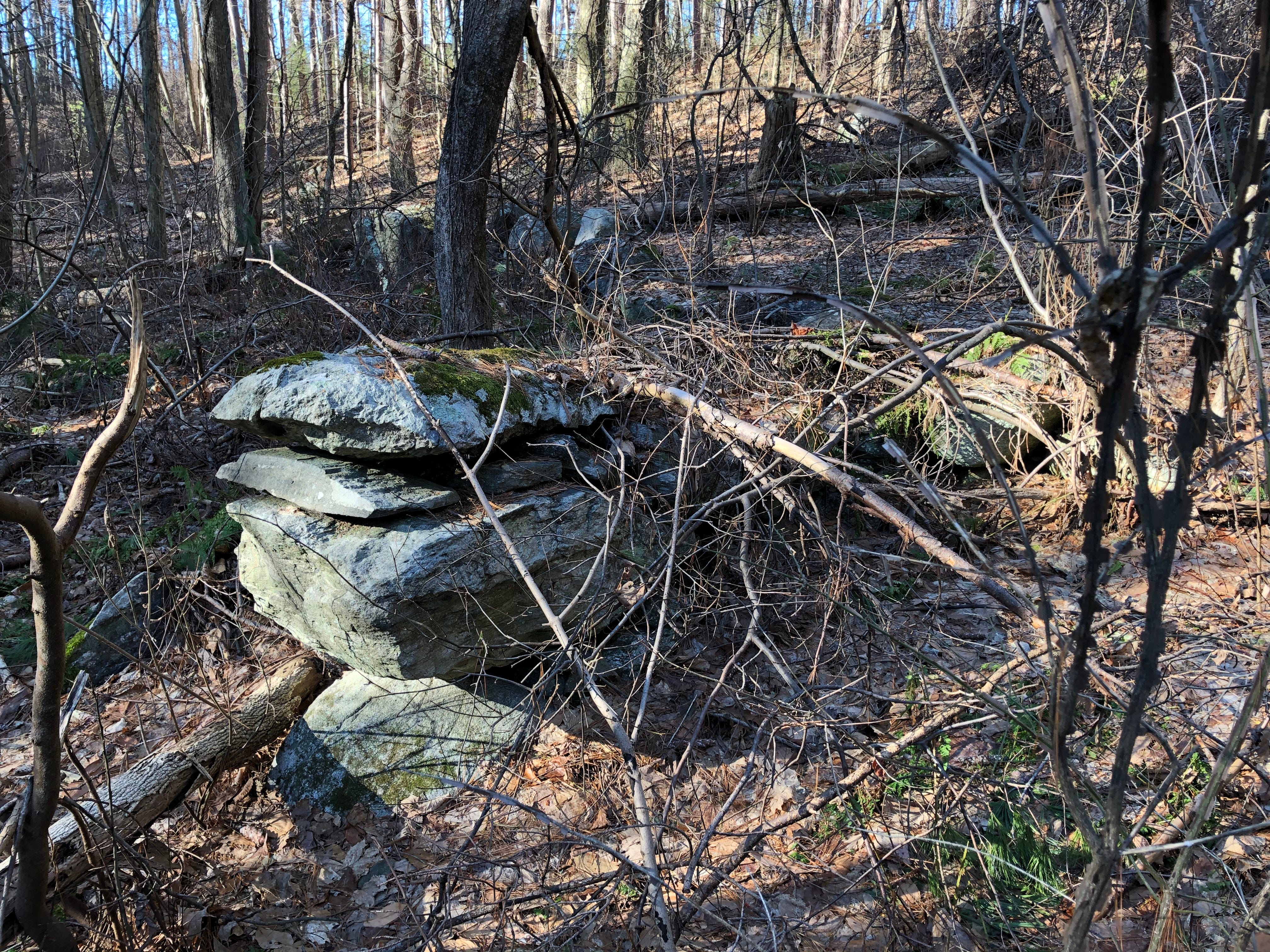
Slightly above this turned head, two boulders were linked by a short stone row. Perhaps the wings of this creature?
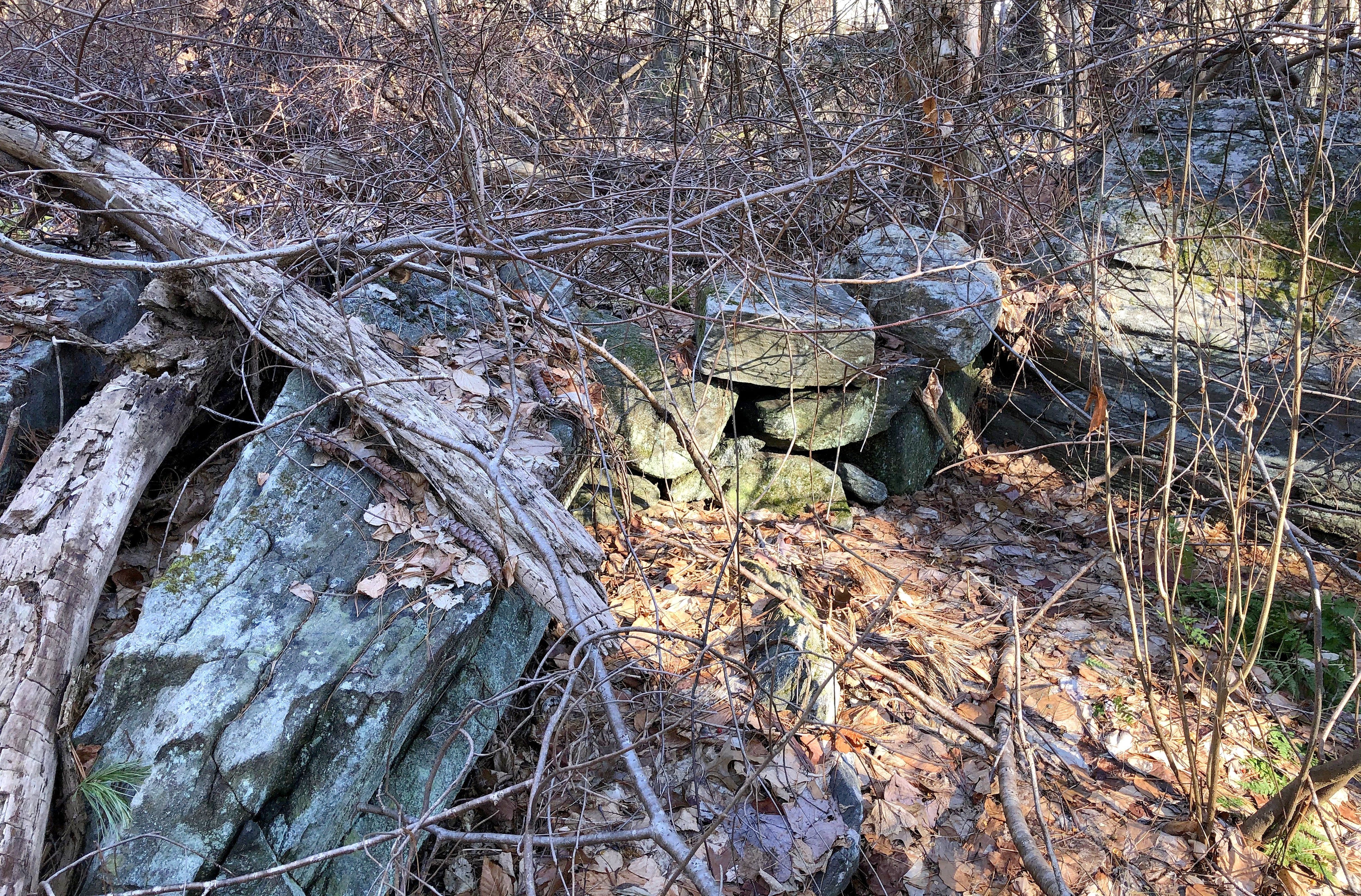
Next to the turned head and linked boulders, the ground appeared covered in larger, flat stones, almost paved. The stone row grew back up out of this stepped platform beside the linked boulders.
The row then, once again, ran along the wetland, until reaching and ending at a hill topped by a cell tower, and fencing that separates these wetlands from the ones north of that hill, with the water works.
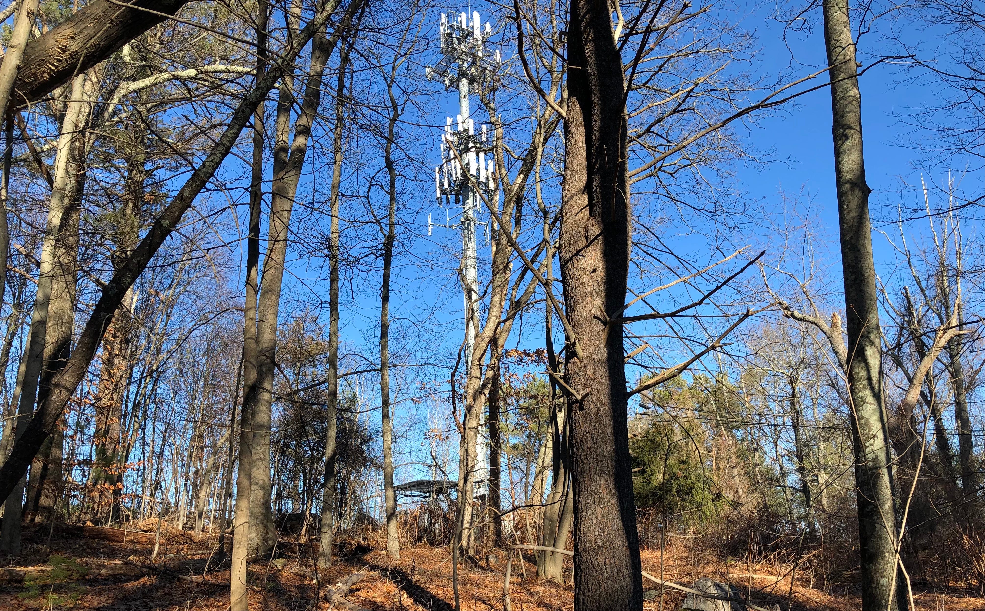
At that time, a year ago, with only a faulty memory of the Rock Piles map in memory, I was afraid the hilltop stones had been destroyed to make way for the cell tower. Luckily, that was not the case. That hill was further to the north.
I later discovered that Gates Pond was in Berlin, not Hudson, and that I’d not found anything from those earlier Rock Piles blog posts.
That happened when occasional Rock Piles contributor Tim MacSweeney shared the video I made from my visit… on the Rock Piles blog!
Talk about full circle.
And just a little embarrassing, as in the comments, Peter Waksman and archaeologist Curtiss Hoffman corrected what I’d gotten wrong.
On the other hand, what I did find hadn’t been found before. And that was pretty cool, in that company.
(Again, Gates Pond is in Berlin… not Hudson. Ahem.)