


Rediscovering Kequasangansett 4
Possible Sacred Stone and Water Works Around Gates Pond in Berlin, Massachusetts

Part Four in a series — read Part One Here, Part Two Here, and Part Three Here.
Whence These Waterworks?
This is Something. But I'm not sure What.
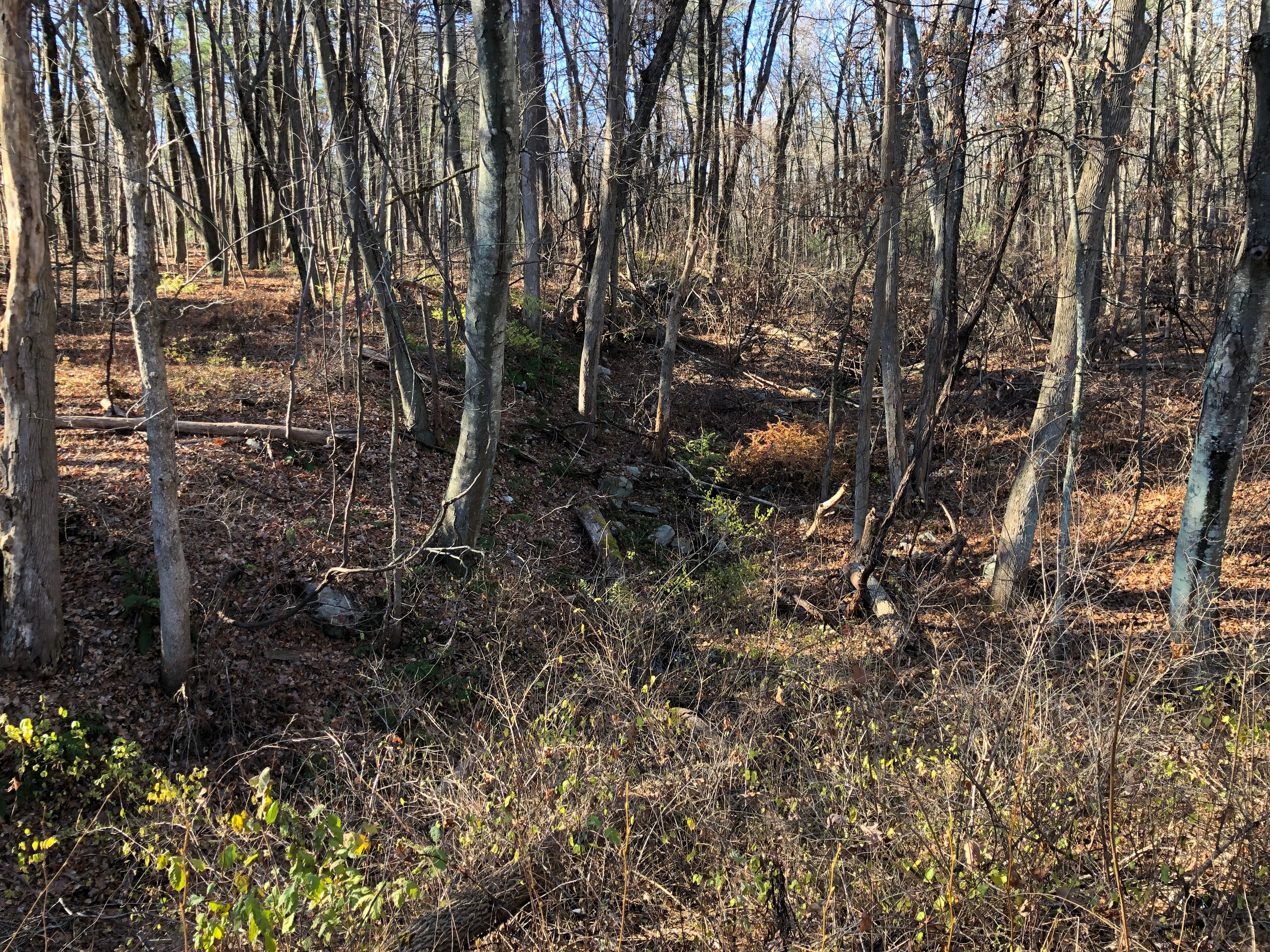
I ventured into the woods north of Gates Pond along what at first seemed to be a raised roadbed, but which narrowed considerably as I walked, proving it was no road. Instead, it seemed stone-lined or stone-constructed berms were lining the sides of a watercourse, and I was on the left side one, as you’re looking into the woods.
The ditches do not appear as orderly as they do on the map. Older works, not depicted, seem to branch off as well. And stone walls or stone rows rise up out of the ditches, in some cases seemingly constructed with them.
In part, this find led to my deeper research. I wanted to know if there were mills here. And, while I did discover there were sawmills near Gates Pond, they were along the southern end of the pond, where Thomas Sawyer Jr. had been abducted.
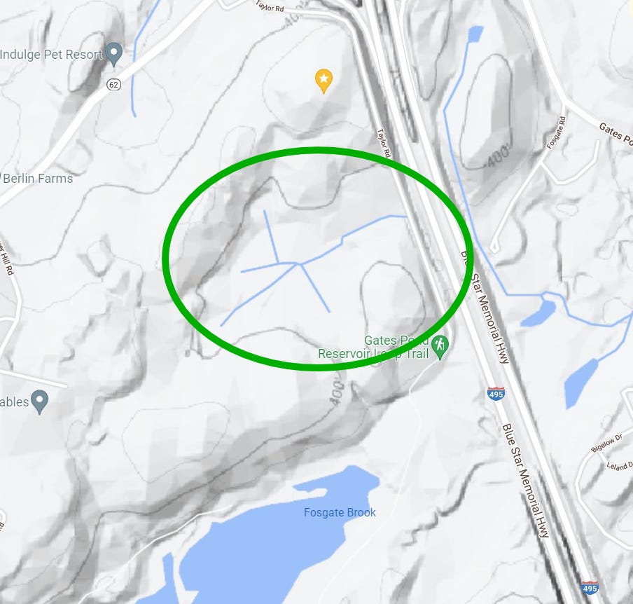
There’s no mention of any waterworks or anything like this on the North End of the pond, but it is on the maps. You can see the rather odd and straight line construction of these little water courses on the map. In fact the Southern Bank seemed to be entirely constructed, made up of stone.
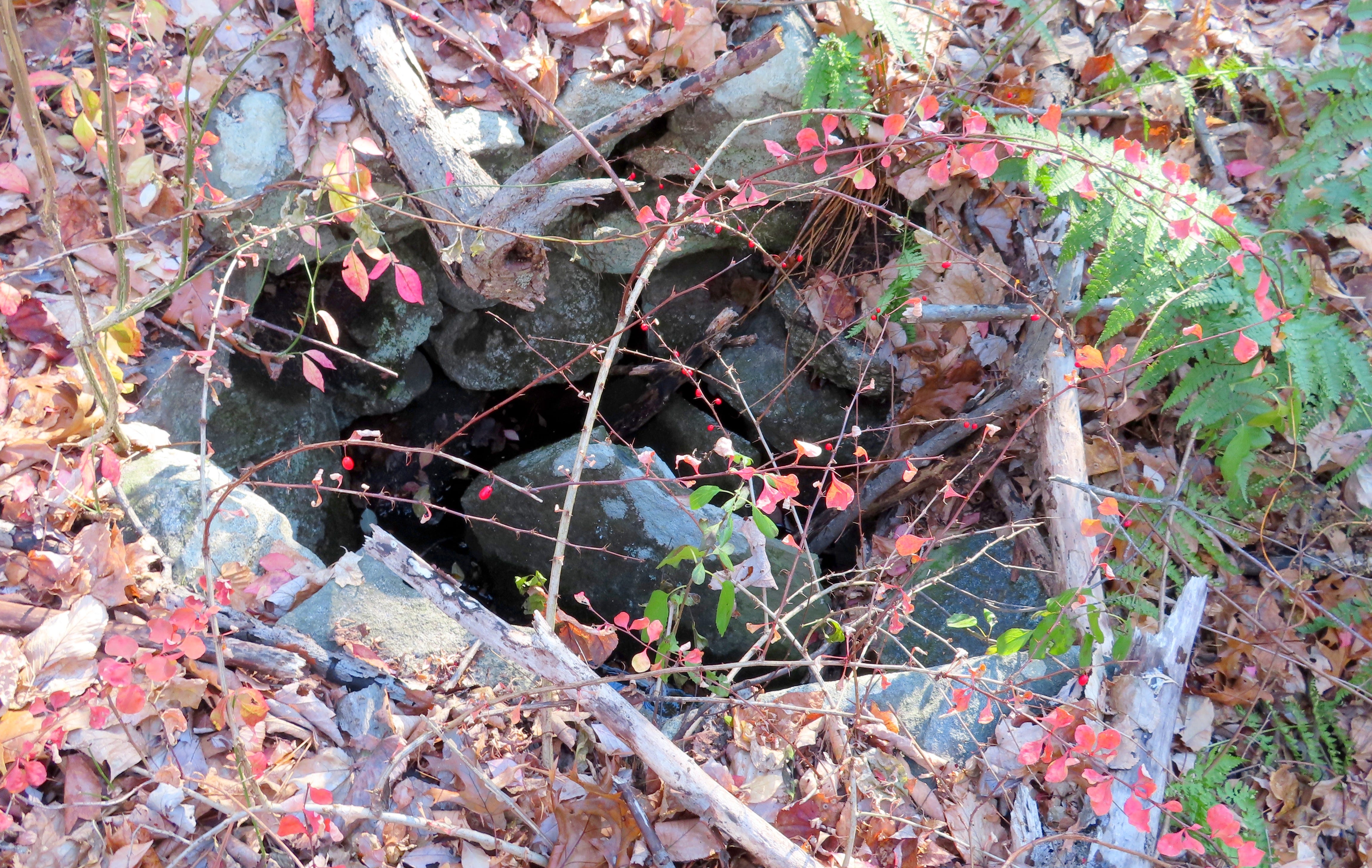
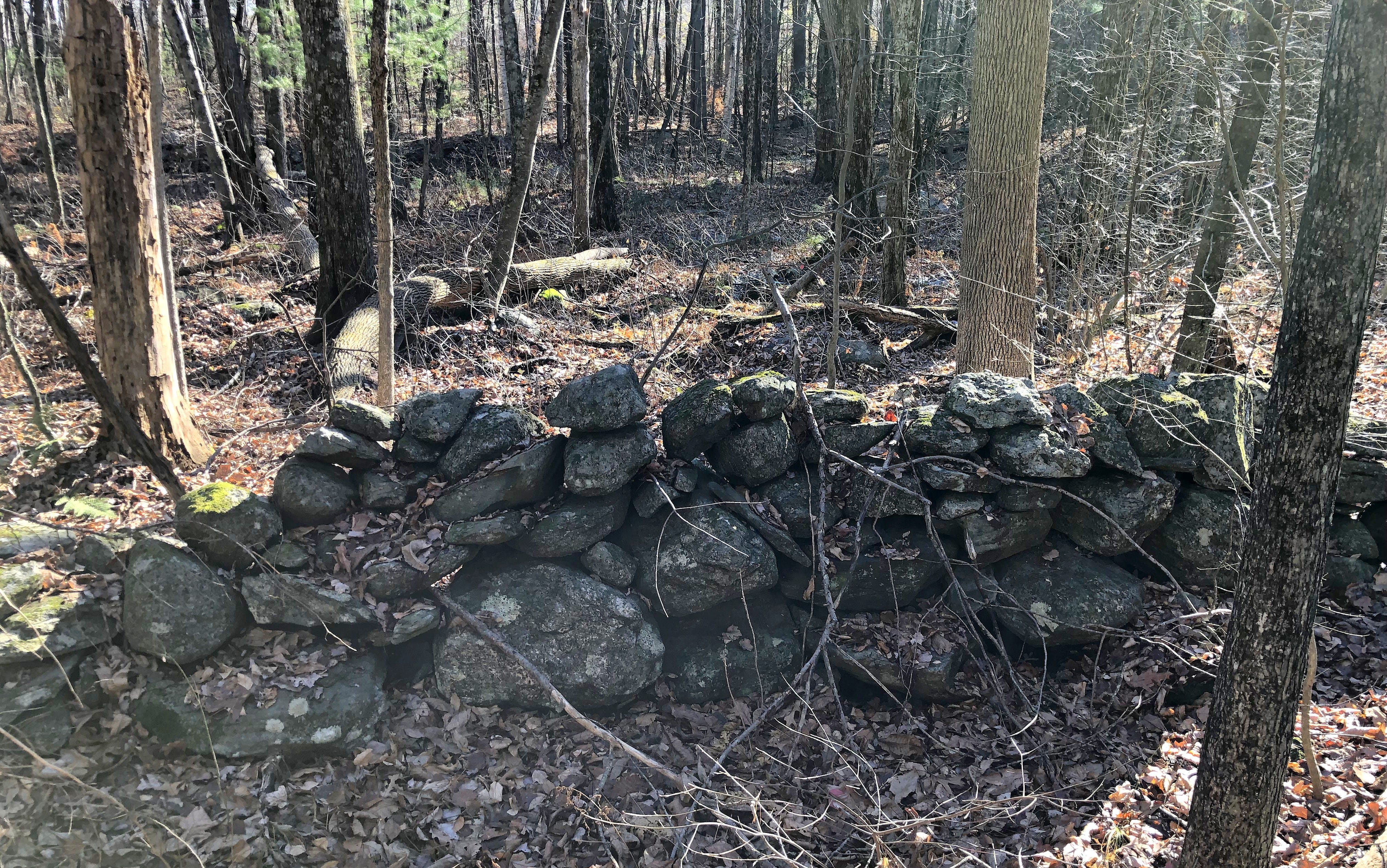
This is where I discovered a stone-lined spring. A small U-shaped assemblage was further in, on the north side. They almost felt… revealed?
Sometimes, you simply feel a place... as if you're kind of tuned-in to it. Not that it's communicating to you, like it's a personal thing. More like a broadcast - it's just there, being itself. Bur, if you have the right equipment to pull in its wavelengths, you can sense it, on some level.
What that equipment is, or what that level is? That's hard to say, as it is a subjective experience. I came to it by way of attempting to cultivate an active, imaginative form of perception, trying to cast my imagination out like a net as I asked and wondered, "what is this place?" Or the equivalent.
These seem to be ancient waterworks north of Gates Pond which were fascinating me, with the sense some of this was very old. Ancient, even.
But, then again?
Questions began to arise in my mind.
Could it be natural? Not likely...
Could it be mundane? Recent? Gates Pond has been part of a public water supply, it could be the town's old work.
Or could it be from before that, perhaps farmers' irrigation ditches?
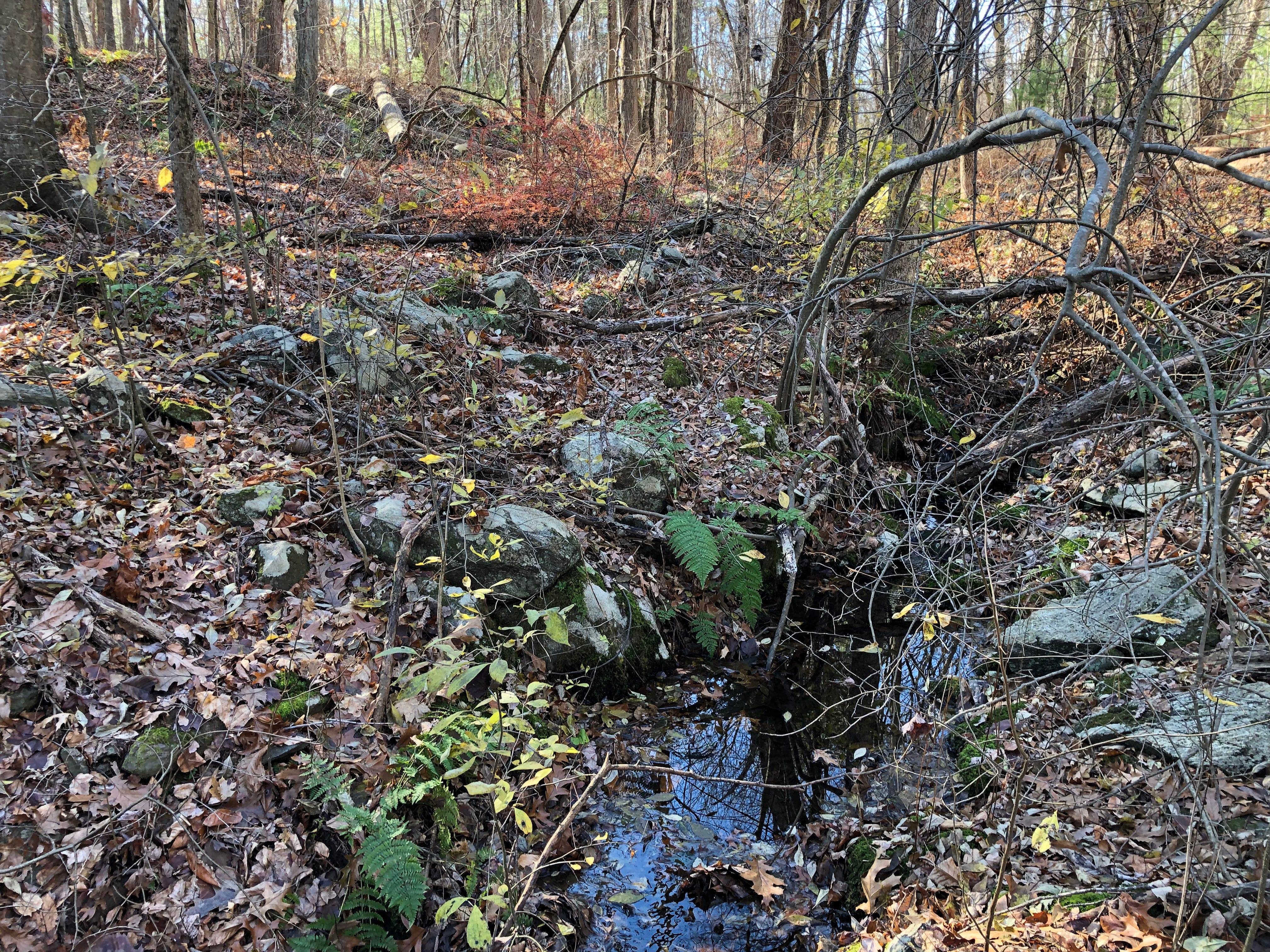
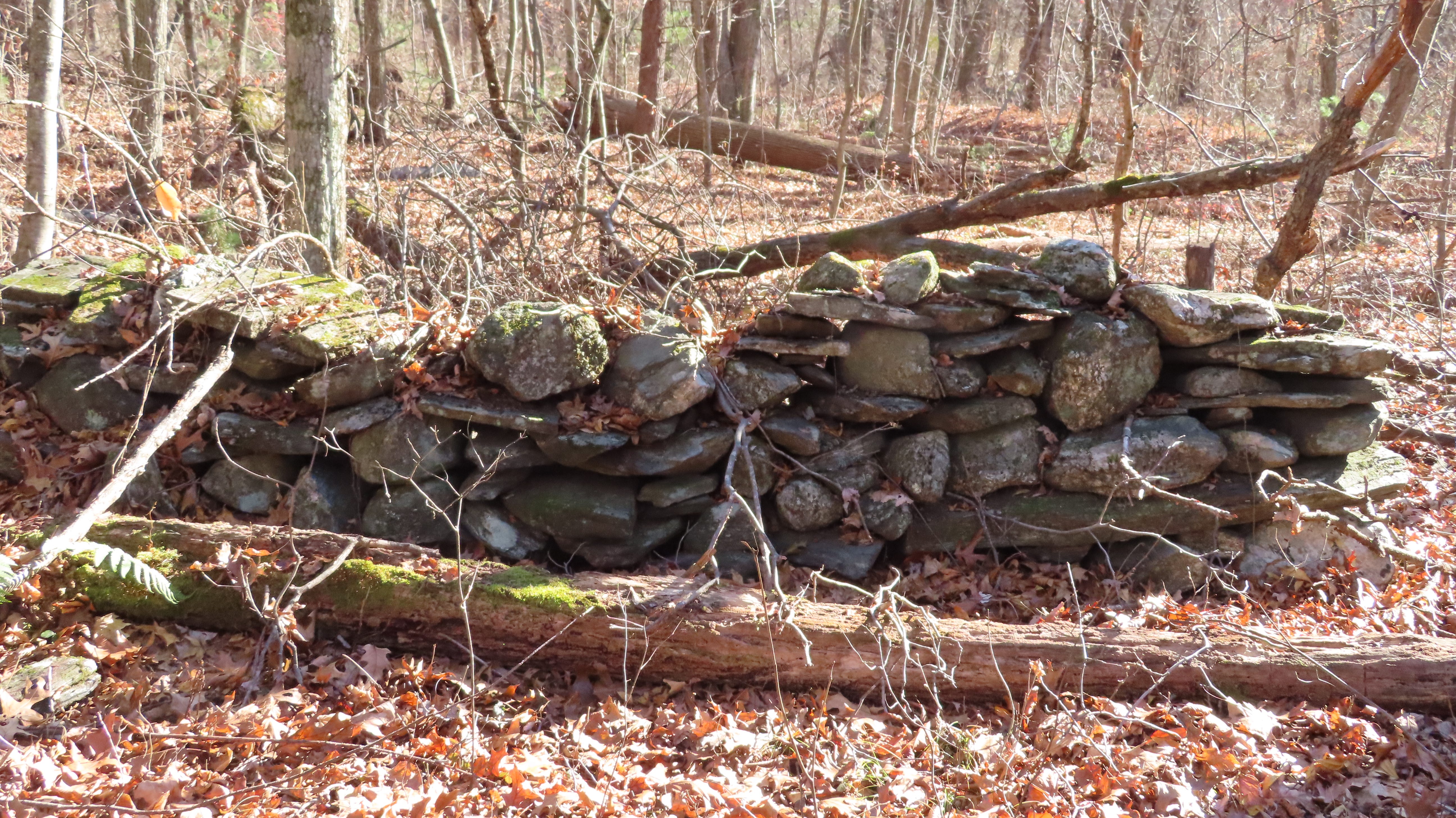
As I walked along, observing and thinking, I noticed the banks appeared to be artificially made. There was a great deal of stone to be seen in their possible construction, and more strewn around and about from their slow deconstruction.

It occurred to me it would be nice to find something provably constructed in the stony bank - that would help answer some questions. And that’s when I found the stone-lined spring. In that bank.
But it hasn't really answered any questions, as of yet.
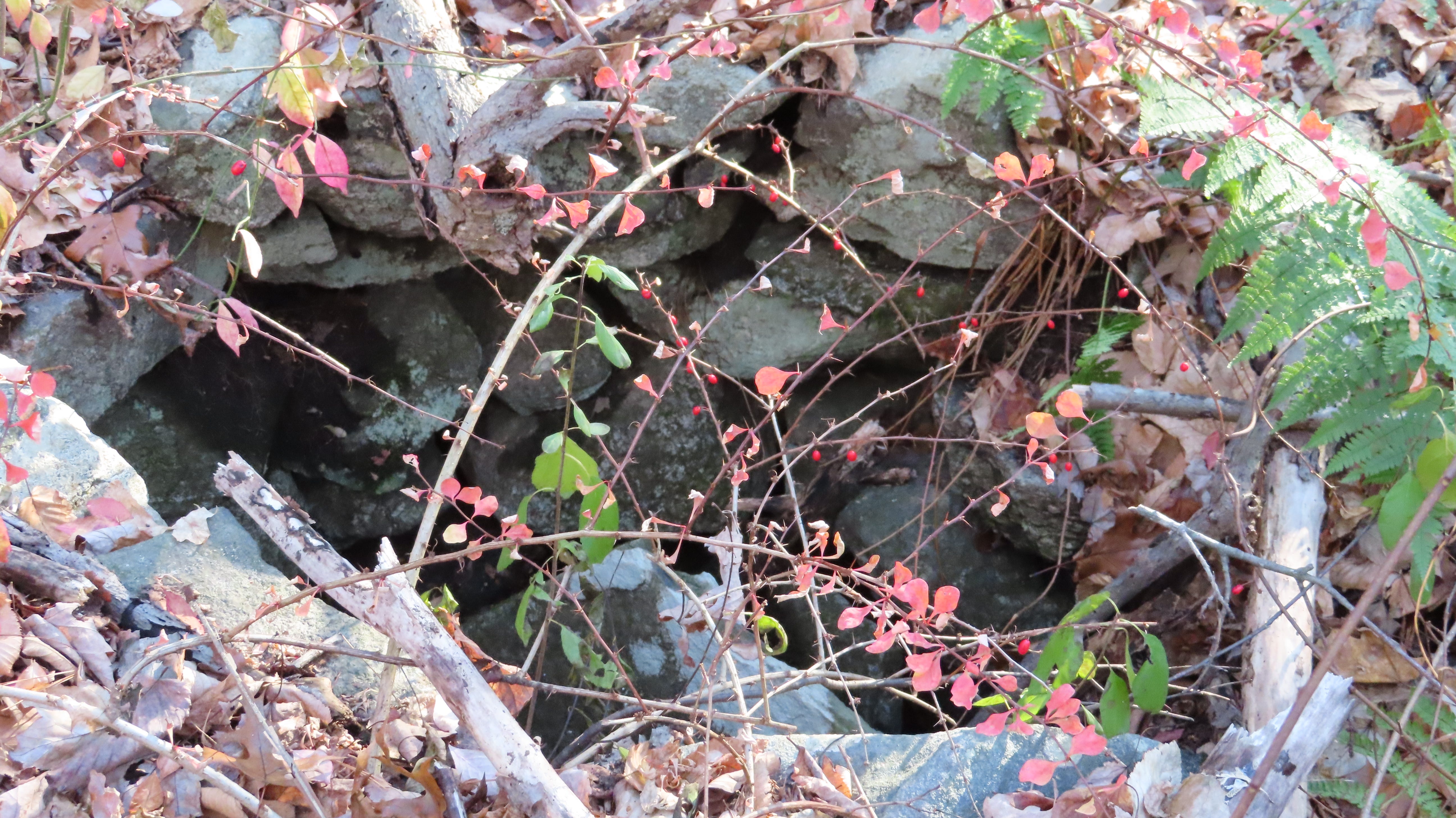
It was also surprisingly hard to capture well on camera.
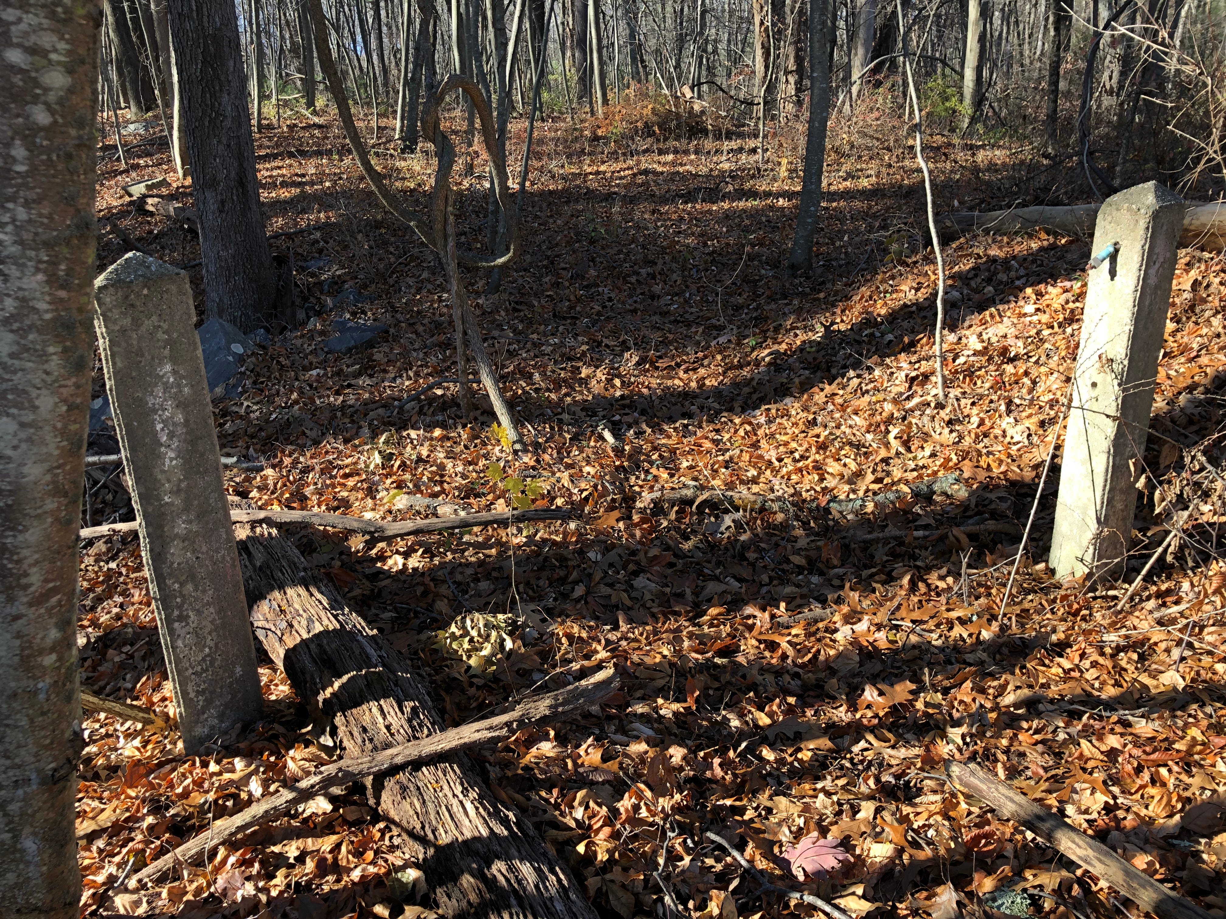
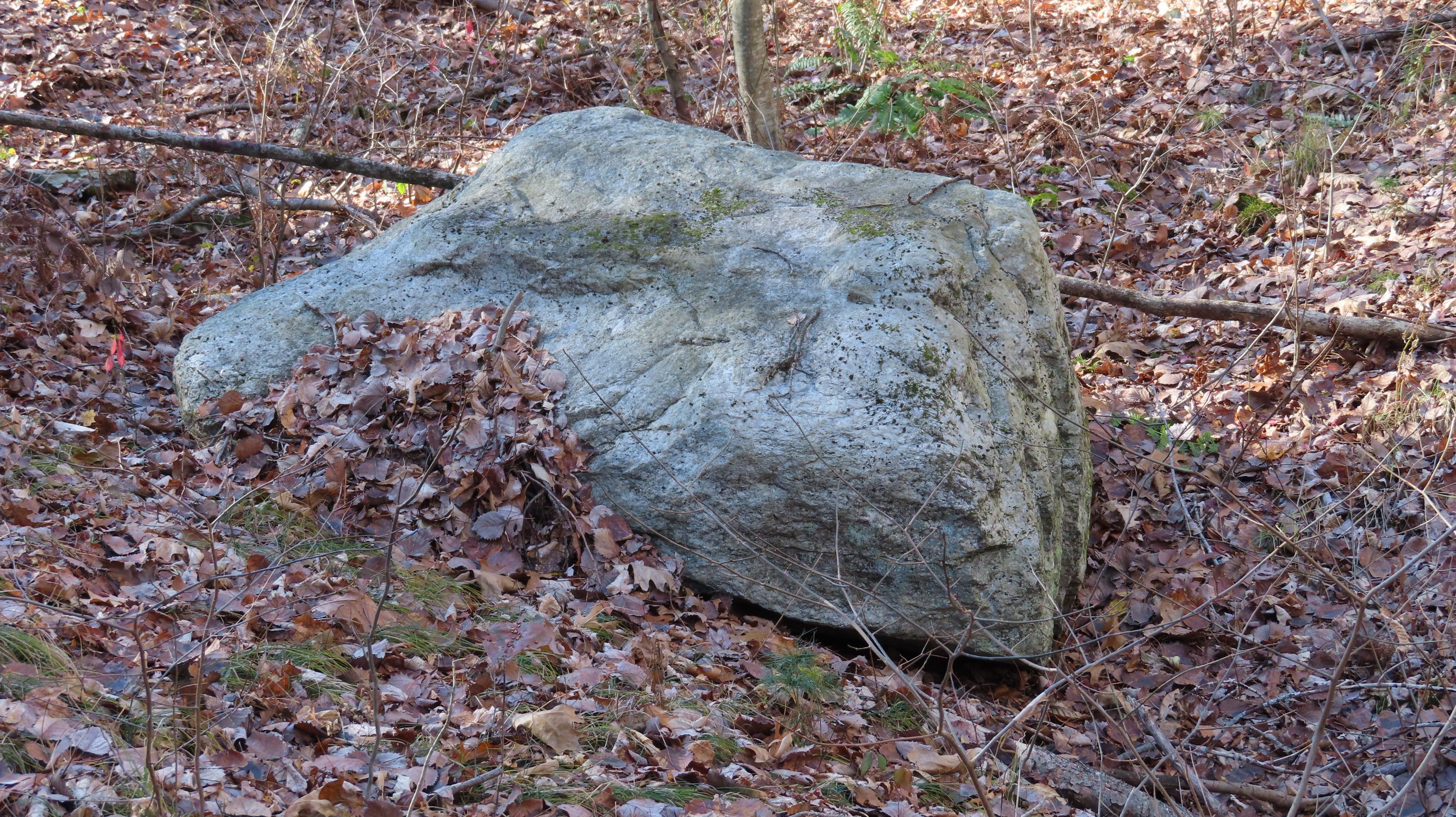
Further back into the woods, barely visible among the fresh blanket of fallen leaves, a U-Shaped Structure still stood out and caught my attention, toward the back or west of the waterworks north of the pond.

It’s hard to say how extensive these ditches were. And they do seem quite old. The stones now tumbled down and degraded a bit. But there are curious features including the U-Shaped structure and the stone lined spring.
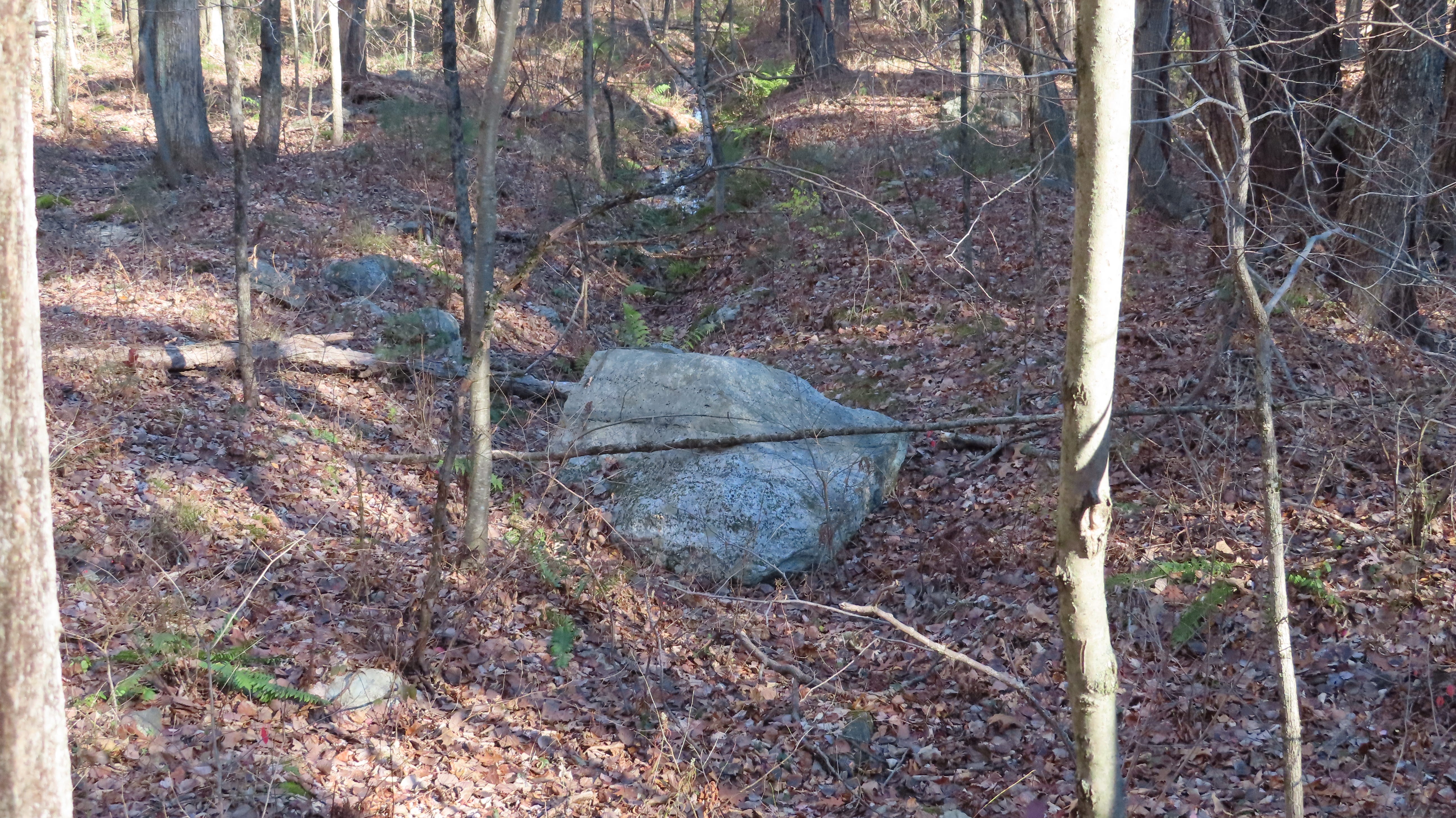
There are also boulders in these stone lined ditches which look like they could have been primitive sluice gates, to allow or block water flow.
Were these ancient mill races? Later town water works?
Maybe the Town of Hudson built these? Trying to clean up the swamp water? There are records of them doing this next to the pond. In the years after acquiring the pond for the town's water supply, the town attempted to find ways to increase the flow of water into the pond.
Towards the end of the 19th Century, the town managed to expand and filter the last section of Fosgate Brook, converting it from swampland. This now simply appears to be the north end of the pond — and you can see how the pond has enlarged when you look at the old and new maps I’ve been sharing. They wrote of digging ditches around the swamp. It could be that this is simply an example of that work.
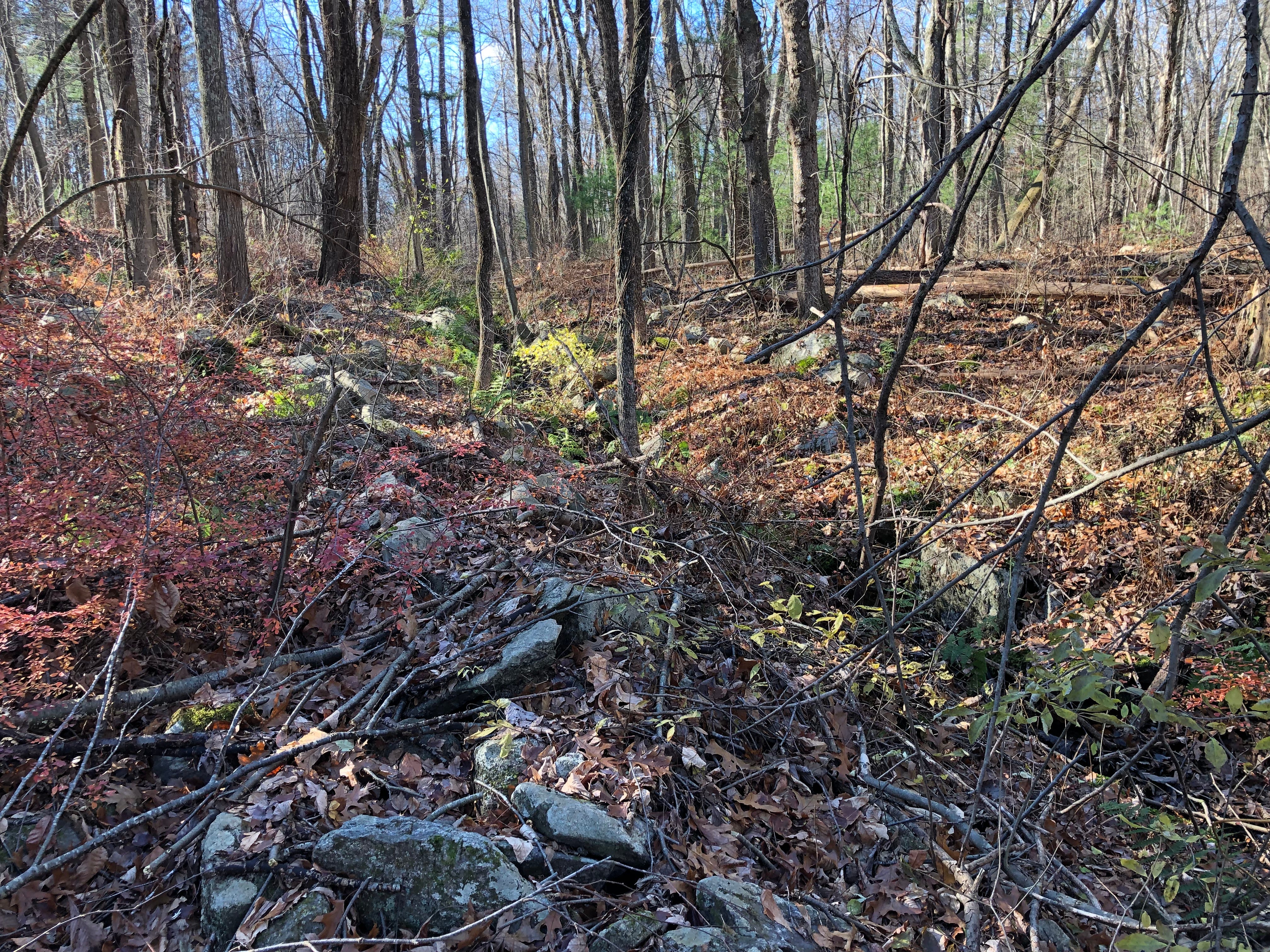
But… what if that work was done on top of older work? Making use of what had been done here, long before? I had to wonder. The stone work towards the “back” grew very curious in appearance. The northern and western limits of the waterworks felt like the back, as Sawyer Hill rose up. The swamp spread out — recent soaking rain had filled the wetlands, giving vernal pools some late autumnal life.
Ancient, serpentine stone rows rose from the wetlands, in some cases snaking right up out of the ditches. Some ended abruptly, or followed strange curving short courses. And, speaking of courses, the stones were not flat stones laid out in even, overlapping courses, but boulders and stones of many shapes and sizes, combined in construction in creative ways — undulating courses and nonsensical shapes.
Nonsensical, that is, until one realizes they are consistently suggestive of serpents, and turtles, presented in Indigenous effigy forms. These old stone rows towards the back of the wetlands and waterworks had the look of indigenous stone work. It reminded me of work I’d seen before… in a notable book.
James Mavor and Byron Dix wrote about possible Indigenous Peoples’ stone work and waterworks in their groundbreaking study MANITOU: The Sacred Landscape of New England’s Native Civilization (Inner Traditions, 1989). Their research on stone work involved with waterways concentrated on Boxborough, about 15 miles northeast of here. Some of the work they describe and picture is remarkably similar to what we see here!
Crediting the Indigenous folks with extensive water and stone works in the Boxborough area, Mavor and Dix write
But by far the most important artifacts left by the native inhabitants of the Nashoba region were the elements of ritual architecture on the landscape. The historical record includes a description of a water management system engineered and constructed by Indians and later reused by colonists to power a sawmill. Also, the Nashoba villagers built two earthen dams and ditch systems that connected three brooks near what is now called Shaker Lane. “In the spring it made them a good supply.” This type of system was common among native New Englanders, and there is a specific Algonquian word for it, Pemmoquittaquomut, meaning “ponds joined by a ditch.”
Mavor and Dix’s stone work and waterworks were next to the “Indian Praying Village” just to the North, Nashoba, now mostly the town of Littleton, Massachusetts.
This waterworks North of Gates Pond are next to the “Indian Praying Village” of Ockoocangansett, most of which is now my hometown of Hudson, Massachusetts.
Nashoba, Ockoocangansett, and Hassanamessit, the “Indian Praying Village” which later became Grafton, about 15 miles southwest of here, were all established by the Reverend John Eliot in May of 1654 in what was then Nipmuc / Nashaway territory. The Indigenous families of these villages were said by Mavor and Dix to be interrelated in ways the Europeans didn’t understand at the time.
Perhaps these waterworks are interrelated as well.
These possibilities are part of what got me searching for answers, looking into the history of Gates Pond, and Sawyer Hill. I'm still looking.